Bayshint geodata
Bayshint (Central Aimak) is a seat of a second-order administrative division; located in Mongolia in Asia/Ulaanbaatar (GMT+8) time zone. In our database, there are 33 cities with bigger population. Compared to other cities in Mongolia, 54.3% of cities are located further ↑North; 62.6% of cities are located further ←West and 62.6% of cities have higher elevation than Bayshint. Note1


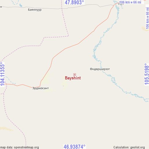
Bayshint GPS coordinates[2]
47° 25' 0.012" North, 104° 49' 0.012" East
| Map corner | latitude | longitude |
|---|---|---|
| Upper-left | 47.8903°, | 104.11355° |
| Center: | 47.41667°, | 104.81667° |
| Lower-right: | 46.93874°, | 105.5198° |
| Map W x H: | 105.8×105.8 km | = 65.7×65.7mi |
| max Lat: | 51.50725° ⇑54.3% North |
| Bayshint: | 47.41667° |
| min Lat: | ⇓45.7% South 42.84199° |
| min Long | Bayshint | max Long |
| 89.14358° | 104.81667° | 118.51014° |
| W 62.6%⇐ | ⇒37.4% E |
Elevation
Elevation of Bayshint is 1256 m = 4121 ft, and this is 160.5 m = 527 ft below average elevation for this country.
| Max E: |
2800 m = 9186 ft | 62.6% |
| Avg. | 1416.5 m = 4647 ft | |
| Bayshint | 1256 m = 4121 ft | |
Min E: |
619 m = 2031 ft | 37.4% |
See also: Mongolia elevation on elevation.city.
Geographical zone
Bayshint is located in North temperate zone (between Tropic of Cancer and the Arctic Circle). Distance of this North polar circle is 2128.9 km =1322.8 mi to North.| Distance of | km | miles | from Bayshint |
|---|---|---|---|
| North Pole | 4734.8 | 2942.1 | to North |
| Arctic Circle | 2128.9 | 1322.8 | to North |
| Tropic Cancer | 2666.3 | 1656.8 | to South |
| Equator | 5272.2 | 3276 | to South |


Nearby cities:
15 places around Bayshint: (largest is in red/bold)
• Ar-Asgat
104 km =64.6 mi,  25°
25°
• Argalant
99.7 km =62 mi,  54°
54°
• Avdzaga
100.5 km =62.4 mi,  283°
283°
• Bat-Öldziyt
88.9 km =55.2 mi,  357°
357°
• Bayantöhöm
58.3 km =36.2 mi,  162°
162°
• Bumbat
115.2 km =71.6 mi,  207°
207°
• Dashinchilling
75 km =46.6 mi,  309°
309°
• Dund-Urt
107.7 km =66.9 mi, 50°
• Hujirt
92.5 km =57.5 mi,  191°
191°
• Ongon
91.7 km =57 mi,  238°
238°
• Sujji
59.6 km =37 mi, 32°
• Tsul-Ulaan
52.1 km =32.4 mi,  332°
332°
• Ulaanhad
81 km =50.3 mi,  42°
42°
• Ulaanhudag
25.6 km =15.9 mi,  248°
248°
• Ulaanshiveet
73.7 km =45.8 mi,  258°
258°
Sources, notices
• [Note1] Compared only with cities in Mongolia existing in our database
• [Src1] Map data: © OpenStreetMap contributors (CC-BY-SA)
• [Src2] Other city data from geonames.org with taken over terms of usage.
• [Src3] Geographical zone / Annual Mean Temperature by Robert A. Rohde @ Wikipedia
