Bat-Öldziyt geodata
Bat-Öldziyt (Central Aimak) is a seat of a second-order administrative division; located in Mongolia in Asia/Ulaanbaatar (GMT+8) time zone. In our database, there are 33 cities with bigger population. Compared to other cities in Mongolia, 61.3% of cities are located further ↓South; 62% of cities are located further ←West and 71.5% of cities have higher elevation than Bat-Öldziyt. Note1


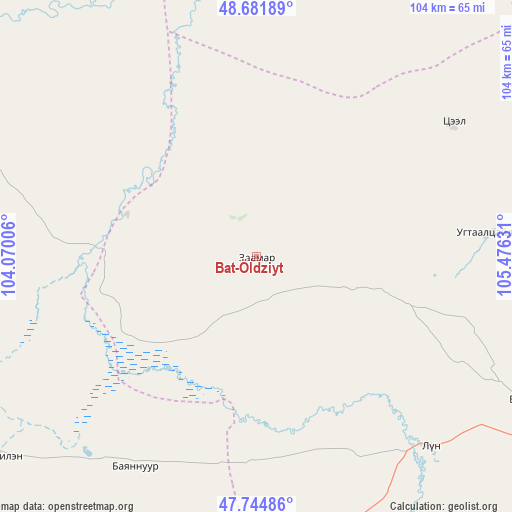
Bat-Öldziyt GPS coordinates[2]
48° 12' 55.872" North, 104° 46' 23.448" East
| Map corner | latitude | longitude |
|---|---|---|
| Upper-left | 48.68189°, | 104.07006° |
| Center: | 48.21552°, | 104.77318° |
| Lower-right: | 47.74486°, | 105.47631° |
| Map W x H: | 104.2×104.2 km | = 64.7×64.7mi |
| max Lat: | 51.50725° ⇑38.7% North |
| Bat-Öldziyt: | 48.21552° |
| min Lat: | ⇓61.3% South 42.84199° |
| min Long | Bat-Öldziyt | max Long |
| 89.14358° | 104.77318° | 118.51014° |
| W 62%⇐ | ⇒38% E |
Elevation
Elevation of Bat-Öldziyt is 1153 m = 3783 ft, and this is 263.5 m = 865 ft below average elevation for this country.
| Max E: |
2800 m = 9186 ft | 71.5% |
| Avg. | 1416.5 m = 4647 ft | |
| Bat-Öldziyt | 1153 m = 3783 ft | |
Min E: |
619 m = 2031 ft | 28.5% |
See also: Mongolia elevation on elevation.city.
Geographical zone
Bat-Öldziyt is located in North temperate zone (between Tropic of Cancer and the Arctic Circle). Distance of this North polar circle is 2040.1 km =1267.7 mi to North.| Distance of | km | miles | from Bat-Öldziyt |
|---|---|---|---|
| North Pole | 4646 | 2886.9 | to North |
| Arctic Circle | 2040.1 | 1267.7 | to North |
| Tropic Cancer | 2755.1 | 1711.9 | to South |
| Equator | 5361.1 | 3331.2 | to South |


Nearby cities:
15 places around Bat-Öldziyt: (largest is in red/bold)
• Ar-Asgat
47.6 km =29.6 mi,  83°
83°
• Argalant
88.8 km =55.2 mi,  110°
110°
• Bayshint
88.9 km =55.2 mi,  177°
177°
• Darhan
66.3 km =41.2 mi,  273°
273°
• Dashinchilling
67.4 km =41.9 mi,  232°
232°
• Dund-Urt
87.5 km =54.4 mi,  103°
103°
• Jargalant
87.7 km =54.5 mi,  67°
67°
• Maanĭt
100.2 km =62.3 mi,  275°
275°
• Mandal
102.8 km =63.9 mi,  296°
296°
• Orgil
48.2 km =30 mi,  56°
56°
• Orhontuul
83 km =51.6 mi,  10°
10°
• Sujji
52.5 km =32.6 mi,  137°
137°
• Tsul-Ulaan
47.1 km =29.3 mi,  205°
205°
• Ulaanhad
65 km =40.4 mi,  117°
117°
• Ulaanhudag
100.2 km =62.3 mi,  191°
191°
Sources, notices
• [Note1] Compared only with cities in Mongolia existing in our database
• [Src1] Map data: © OpenStreetMap contributors (CC-BY-SA)
• [Src2] Other city data from geonames.org with taken over terms of usage.
• [Src3] Geographical zone / Annual Mean Temperature by Robert A. Rohde @ Wikipedia
