Ulaanhudag geodata
Ulaanhudag (Central Aimak) is a seat of a second-order administrative division; located in Mongolia in Asia/Ulaanbaatar (GMT+8) time zone. With population of 1,500 people, there are 29 cities with bigger population in this country. Compared to other cities in Mongolia, 55.8% of cities are located further ↑North; 60.7% of cities are located further ←West and 53.1% of cities have higher elevation than Ulaanhudag. Note1


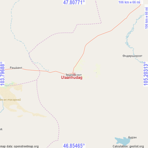
Ulaanhudag GPS coordinates[2]
47° 19' 59.988" North, 104° 30' 0" East
| Map corner | latitude | longitude |
|---|---|---|
| Upper-left | 47.80771°, | 103.79688° |
| Center: | 47.33333°, | 104.5° |
| Lower-right: | 46.85465°, | 105.20313° |
| Map W x H: | 106×106 km | = 65.9×65.9mi |
| max Lat: | 51.50725° ⇑55.8% North |
| Ulaanhudag: | 47.33333° |
| min Lat: | ⇓44.2% South 42.84199° |
| min Long | Ulaanhudag | max Long |
| 89.14358° | 104.5° | 118.51014° |
| W 60.7%⇐ | ⇒39.3% E |
Elevation
Elevation of Ulaanhudag is 1339 m = 4393 ft, and this is 77.5 m = 254 ft below average elevation for this country.
| Max E: |
2800 m = 9186 ft | 53.1% |
| Avg. | 1416.5 m = 4647 ft | |
| Ulaanhudag | 1339 m = 4393 ft | |
Min E: |
619 m = 2031 ft | 46.9% |
See also: Mongolia elevation on elevation.city.
Geographical zone
Ulaanhudag is located in North temperate zone (between Tropic of Cancer and the Arctic Circle). Distance of this North polar circle is 2138.2 km =1328.6 mi to North.| Distance of | km | miles | from Ulaanhudag |
|---|---|---|---|
| North Pole | 4744.1 | 2947.8 | to North |
| Arctic Circle | 2138.2 | 1328.6 | to North |
| Tropic Cancer | 2657.1 | 1651 | to South |
| Equator | 5263 | 3270.3 | to South |


Nearby cities:
15 places around Ulaanhudag: (largest is in red/bold)
• Avdzaga
81.1 km =50.4 mi,  294°
294°
• Bat-Öldziyt
100.2 km =62.3 mi,  11°
11°
• Bayan
102.4 km =63.6 mi,  277°
277°
• Bayantöhöm
62.3 km =38.7 mi,  138°
138°
• Bayshint
25.6 km =15.9 mi,  68°
68°
• Bumbat
97.4 km =60.5 mi,  197°
197°
• Darhan
112.4 km =69.8 mi,  335°
335°
• Dashinchilling
66.6 km =41.4 mi,  329°
329°
• Hujirt
81.8 km =50.8 mi,  175°
175°
• Mönhbulag
98.8 km =61.4 mi,  228°
228°
• Ongon
66.7 km =41.4 mi, 234°
• Sujji
81.7 km =50.8 mi,  43°
43°
• Tsul-Ulaan
55.6 km =34.5 mi,  0°
0°
• Ulaanhad
104.5 km =64.9 mi,  49°
49°
• Ulaanshiveet
48.7 km =30.3 mi,  264°
264°
Sources, notices
• [Note1] Compared only with cities in Mongolia existing in our database
• [Src1] Map data: © OpenStreetMap contributors (CC-BY-SA)
• [Src2] Other city data from geonames.org with taken over terms of usage.
• [Src3] Geographical zone / Annual Mean Temperature by Robert A. Rohde @ Wikipedia
