Avdzaga geodata
Avdzaga (Bulgan) is a seat of a second-order administrative division; located in Mongolia in Asia/Ulaanbaatar (GMT+8) time zone. In our database, there are 33 cities with bigger population. Compared to other cities in Mongolia, 50.9% of cities are located further ↑North; 54.3% of cities are located further ←West and 73% of cities have higher elevation than Avdzaga. Note1


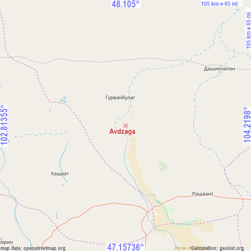
Avdzaga GPS coordinates[2]
47° 37' 59.988" North, 103° 31' 0.012" East
| Map corner | latitude | longitude |
|---|---|---|
| Upper-left | 48.105°, | 102.81355° |
| Center: | 47.63333°, | 103.51667° |
| Lower-right: | 47.15736°, | 104.2198° |
| Map W x H: | 105.4×105.4 km | = 65.5×65.5mi |
| max Lat: | 51.50725° ⇑50.9% North |
| Avdzaga: | 47.63333° |
| min Lat: | ⇓49.1% South 42.84199° |
| min Long | Avdzaga | max Long |
| 89.14358° | 103.51667° | 118.51014° |
| W 54.3%⇐ | ⇒45.7% E |
Elevation
Elevation of Avdzaga is 1137 m = 3730 ft, and this is 279.5 m = 917 ft below average elevation for this country.
| Max E: |
2800 m = 9186 ft | 73% |
| Avg. | 1416.5 m = 4647 ft | |
| Avdzaga | 1137 m = 3730 ft | |
Min E: |
619 m = 2031 ft | 27% |
See also: Mongolia elevation on elevation.city.
Geographical zone
Avdzaga is located in North temperate zone (between Tropic of Cancer and the Arctic Circle). Distance of this North polar circle is 2104.8 km =1307.9 mi to North.| Distance of | km | miles | from Avdzaga |
|---|---|---|---|
| North Pole | 4710.7 | 2927.1 | to North |
| Arctic Circle | 2104.8 | 1307.9 | to North |
| Tropic Cancer | 2690.4 | 1671.7 | to South |
| Equator | 5296.3 | 3291 | to South |


Nearby cities:
15 places around Avdzaga: (largest is in red/bold)
• Bayan
34.2 km =21.3 mi,  233°
233°
• Darhan
74.2 km =46.1 mi,  21°
21°
• Dashinchilling
46.6 km =29 mi,  58°
58°
• Dzegstey
72.5 km =45 mi,  273°
273°
• Erhet
81.6 km =50.7 mi,  330°
330°
• Harhorin
71.2 km =44.2 mi, 227°
• Hotont
84.3 km =52.4 mi,  249°
249°
• Höshööt
88.5 km =55 mi,  305°
305°
• Kharkhorin
72.1 km =44.8 mi, 227°
• Maanĭt
74.1 km =46 mi,  354°
354°
• Mönhbulag
98.2 km =61 mi,  180°
180°
• Ongon
75.1 km =46.7 mi,  164°
164°
• Tsul-Ulaan
76.8 km =47.7 mi,  73°
73°
• Ulaanhudag
81.1 km =50.4 mi,  114°
114°
• Ulaanshiveet
46 km =28.6 mi,  146°
146°
Sources, notices
• [Note1] Compared only with cities in Mongolia existing in our database
• [Src1] Map data: © OpenStreetMap contributors (CC-BY-SA)
• [Src2] Other city data from geonames.org with taken over terms of usage.
• [Src3] Geographical zone / Annual Mean Temperature by Robert A. Rohde @ Wikipedia
