Ar-Asgat geodata
Ar-Asgat (Central Aimak) is a seat of a second-order administrative division; located in Mongolia in Asia/Ulaanbaatar (GMT+8) time zone. In our database, there are 33 cities with bigger population. Compared to other cities in Mongolia, 62.9% of cities are located further ↓South; 66% of cities are located further ←West and 70.6% of cities have higher elevation than Ar-Asgat. Note1


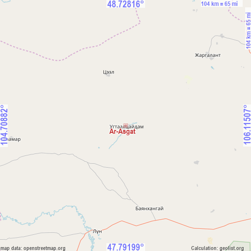
Ar-Asgat GPS coordinates[2]
48° 15' 43.992" North, 105° 24' 42.984" East
| Map corner | latitude | longitude |
|---|---|---|
| Upper-left | 48.72816°, | 104.70882° |
| Center: | 48.26222°, | 105.41194° |
| Lower-right: | 47.79199°, | 106.11507° |
| Map W x H: | 104.1×104.1 km | = 64.7×64.7mi |
| max Lat: | 51.50725° ⇑37.1% North |
| Ar-Asgat: | 48.26222° |
| min Lat: | ⇓62.9% South 42.84199° |
| min Long | Ar-Asgat | max Long |
| 89.14358° | 105.41194° | 118.51014° |
| W 66%⇐ | ⇒34% E |
Elevation
Elevation of Ar-Asgat is 1169 m = 3835 ft, and this is 247.5 m = 812 ft below average elevation for this country.
| Max E: |
2800 m = 9186 ft | 70.6% |
| Avg. | 1416.5 m = 4647 ft | |
| Ar-Asgat | 1169 m = 3835 ft | |
Min E: |
619 m = 2031 ft | 29.4% |
See also: Mongolia elevation on elevation.city.
Geographical zone
Ar-Asgat is located in North temperate zone (between Tropic of Cancer and the Arctic Circle). Distance of this North polar circle is 2034.9 km =1264.4 mi to North.| Distance of | km | miles | from Ar-Asgat |
|---|---|---|---|
| North Pole | 4640.8 | 2883.7 | to North |
| Arctic Circle | 2034.9 | 1264.4 | to North |
| Tropic Cancer | 2760.3 | 1715.2 | to South |
| Equator | 5366.3 | 3334.5 | to South |


Nearby cities:
15 places around Ar-Asgat: (largest is in red/bold)
• Altanbulag
96.5 km =60 mi,  130°
130°
• Argalant
50.6 km =31.4 mi, 134°
• Bat-Öldziyt
47.6 km =29.6 mi,  263°
263°
• Bornuur
67.1 km =41.7 mi,  70°
70°
• Dund-Urt
45.3 km =28.1 mi,  123°
123°
• Ihsüüj
65.3 km =40.6 mi,  93°
93°
• Jargalant
44.3 km =27.5 mi,  49°
49°
• Javhlant
70.9 km =44.1 mi,  32°
32°
• Mandal
99 km =61.5 mi,  83°
83°
• Nart
98.2 km =61 mi,  358°
358°
• Orgil
22.4 km =13.9 mi,  341°
341°
• Orhontuul
82.9 km =51.5 mi, 337°
• Sujji
45.6 km =28.3 mi,  195°
195°
• Tsul-Ulaan
82.9 km =51.5 mi,  234°
234°
• Ulaanhad
36.3 km =22.6 mi,  163°
163°
Sources, notices
• [Note1] Compared only with cities in Mongolia existing in our database
• [Src1] Map data: © OpenStreetMap contributors (CC-BY-SA)
• [Src2] Other city data from geonames.org with taken over terms of usage.
• [Src3] Geographical zone / Annual Mean Temperature by Robert A. Rohde @ Wikipedia
