Övt geodata
Övt (Övörhangay) is a seat of a second-order administrative division; located in Mongolia in Asia/Ulaanbaatar (GMT+8) time zone. In our database, there are 33 cities with bigger population. Compared to other cities in Mongolia, 65% of cities are located further ↑North; 53.1% of cities are located further →East and 73.6% of cities have lower elevation than Övt. Note1


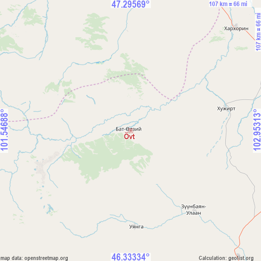
Övt GPS coordinates[2]
46° 49' 0.012" North, 102° 15' 0" East
| Map corner | latitude | longitude |
|---|---|---|
| Upper-left | 47.29569°, | 101.54688° |
| Center: | 46.81667°, | 102.25° |
| Lower-right: | 46.33334°, | 102.95313° |
| Map W x H: | 107×107 km | = 66.5×66.5mi |
| max Lat: | 51.50725° ⇑65% North |
| Övt: | 46.81667° |
| min Lat: | ⇓35% South 42.84199° |
| min Long | Övt | max Long |
| 89.14358° | 102.25° | 118.51014° |
| W 46.9%⇐ | ⇒53.1% E |
Elevation
Elevation of Övt is 1681 m = 5515 ft, and this is 264.5 m = 868 ft above average elevation for this country.
| Max E: |
2800 m = 9186 ft | 26.4% |
| Övt | 1681 m 5515 ft | |
| Avg. | 1416.5 m = 4647 ft | |
Min E: |
619 m = 2031 ft | 73.6% |
See also: Mongolia elevation on elevation.city.
Geographical zone
Övt is located in North temperate zone (between Tropic of Cancer and the Arctic Circle). Distance of this North polar circle is 2195.6 km =1364.3 mi to North.| Distance of | km | miles | from Övt |
|---|---|---|---|
| North Pole | 4801.5 | 2983.5 | to North |
| Arctic Circle | 2195.6 | 1364.3 | to North |
| Tropic Cancer | 2599.6 | 1615.3 | to South |
| Equator | 5205.5 | 3234.5 | to South |


Nearby cities:
15 places around Övt: (largest is in red/bold)
• Altan-Ovoo
79.5 km =49.4 mi,  331°
331°
• Arvayheer
73.4 km =45.6 mi,  146°
146°
• Bayan-Ulaan
42 km =26.1 mi,  141°
141°
• Dzegstey
97.3 km =60.5 mi,  13°
13°
• Harhorin
60.7 km =37.7 mi,  45°
45°
• Hotont
62.9 km =39.1 mi,  15°
15°
• Hüremt
59.1 km =36.7 mi,  165°
165°
• Kharkhorin
59.8 km =37.2 mi, 45°
• Khujirt
40.5 km =25.2 mi,  77°
77°
• Mardzad
97.6 km =60.6 mi,  189°
189°
• Mönhbulag
96.7 km =60.1 mi,  94°
94°
• Ongi
39 km =24.2 mi,  176°
176°
• Sangiyn Dalay
83.4 km =51.8 mi,  102°
102°
• Tavanbulag
68 km =42.3 mi,  337°
337°
• Tsetserleg
94.8 km =58.9 mi,  320°
320°
Sources, notices
• [Note1] Compared only with cities in Mongolia existing in our database
• [Src1] Map data: © OpenStreetMap contributors (CC-BY-SA)
• [Src2] Other city data from geonames.org with taken over terms of usage.
• [Src3] Geographical zone / Annual Mean Temperature by Robert A. Rohde @ Wikipedia
