Örgön geodata
Örgön (Bayanhongor) is a seat of a second-order administrative division; located in Mongolia in Asia/Ulaanbaatar (GMT+8) time zone. In our database, there are 33 cities with bigger population. Compared to other cities in Mongolia, 91.7% of cities are located further ↑North; 63.8% of cities are located further →East and 69% of cities have lower elevation than Örgön. Note1


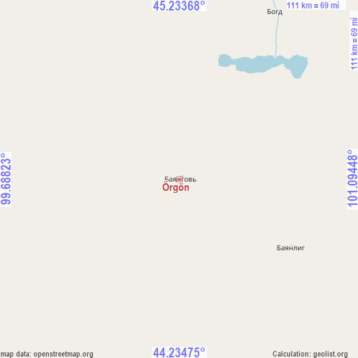
Örgön GPS coordinates[2]
44° 44' 10.932" North, 100° 23' 28.86" East
| Map corner | latitude | longitude |
|---|---|---|
| Upper-left | 45.23368°, | 99.68823° |
| Center: | 44.73637°, | 100.39135° |
| Lower-right: | 44.23475°, | 101.09448° |
| Map W x H: | 111.1×111.1 km | = 69×69mi |
| max Lat: | 51.50725° ⇑91.7% North |
| Örgön: | 44.73637° |
| min Lat: | ⇓8.3% South 42.84199° |
| min Long | Örgön | max Long |
| 89.14358° | 100.39135° | 118.51014° |
| W 36.2%⇐ | ⇒63.8% E |
Elevation
Elevation of Örgön is 1584 m = 5197 ft, and this is 167.5 m = 550 ft above average elevation for this country.
| Max E: |
2800 m = 9186 ft | 31% |
| Örgön | 1584 m 5197 ft | |
| Avg. | 1416.5 m = 4647 ft | |
Min E: |
619 m = 2031 ft | 69% |
See also: Mongolia elevation on elevation.city.
Geographical zone
Örgön is located in North temperate zone (between Tropic of Cancer and the Arctic Circle). Distance of this Northern Tropic circle is 2368.3 km =1471.6 mi to South.| Distance of | km | miles | from Örgön |
|---|---|---|---|
| North Pole | 5032.8 | 3127.2 | to North |
| Arctic Circle | 2427 | 1508.1 | to North |
| Tropic Cancer | 2368.3 | 1471.6 | to South |
| Equator | 4974.2 | 3090.8 | to South |


Nearby cities:
15 places around Örgön: (largest is in red/bold)
• Bayan Uula Sumu
92.7 km =57.6 mi,  58°
58°
• Bayanhongor
164.1 km =102 mi,  8°
8°
• Bayansayr
118.1 km =73.4 mi,  320°
320°
• Bodĭ
76.4 km =47.5 mi, 10°
• Bulgan
137.6 km =85.5 mi,  272°
272°
• Dzadgay
175.2 km =108.9 mi,  339°
339°
• Dzalaa
91.8 km =57 mi,  255°
255°
• Hatansuudal
40.5 km =25.2 mi,  121°
121°
• Horiult
59.4 km =36.9 mi,  29°
29°
• Hovd
141.1 km =87.7 mi,  92°
92°
• Hovd
157.6 km =97.9 mi, 92°
• Höhbürd
172.3 km =107.1 mi,  1°
1°
• Tsagaan-Ovoo
160 km =99.4 mi, 31°
• Ulaan-Uul
151.7 km =94.3 mi, 12°
• Urt
175.3 km =108.9 mi,  162°
162°
Sources, notices
• [Note1] Compared only with cities in Mongolia existing in our database
• [Src1] Map data: © OpenStreetMap contributors (CC-BY-SA)
• [Src2] Other city data from geonames.org with taken over terms of usage.
• [Src3] Geographical zone / Annual Mean Temperature by Robert A. Rohde @ Wikipedia
