Dzalaa geodata
Dzalaa (Bayanhongor) is a seat of a second-order administrative division; located in Mongolia in Asia/Ulaanbaatar (GMT+8) time zone. In our database, there are 33 cities with bigger population. Compared to other cities in Mongolia, 94.2% of cities are located further ↑North; 69.6% of cities are located further →East and 97.2% of cities have lower elevation than Dzalaa. Note1


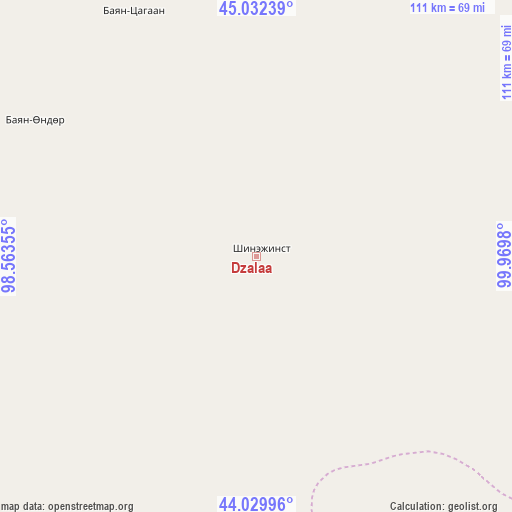
Dzalaa GPS coordinates[2]
44° 31' 59.988" North, 99° 16' 0.012" East
| Map corner | latitude | longitude |
|---|---|---|
| Upper-left | 45.03239°, | 98.56355° |
| Center: | 44.53333°, | 99.26667° |
| Lower-right: | 44.02996°, | 99.9698° |
| Map W x H: | 111.5×111.5 km | = 69.3×69.3mi |
| max Lat: | 51.50725° ⇑94.2% North |
| Dzalaa: | 44.53333° |
| min Lat: | ⇓5.8% South 42.84199° |
| min Long | Dzalaa | max Long |
| 89.14358° | 99.26667° | 118.51014° |
| W 30.4%⇐ | ⇒69.6% E |
Elevation
Elevation of Dzalaa is 2262 m = 7421 ft, and this is 845.5 m = 2774 ft above average elevation for this country.
| Max E: |
2800 m = 9186 ft | 2.8% |
| Dzalaa | 2262 m 7421 ft | |
| Avg. | 1416.5 m = 4647 ft | |
Min E: |
619 m = 2031 ft | 97.2% |
See also: Mongolia elevation on elevation.city.
Geographical zone
Dzalaa is located in North temperate zone (between Tropic of Cancer and the Arctic Circle). Distance of this Northern Tropic circle is 2345.7 km =1457.5 mi to South.| Distance of | km | miles | from Dzalaa |
|---|---|---|---|
| North Pole | 5055.4 | 3141.3 | to North |
| Arctic Circle | 2449.5 | 1522 | to North |
| Tropic Cancer | 2345.7 | 1457.5 | to South |
| Equator | 4951.6 | 3076.8 | to South |


Nearby cities:
15 places around Dzalaa: (largest is in red/bold)
• Bayan Uula Sumu
182.3 km =113.3 mi,  67°
67°
• Bayansayr
114.4 km =71.1 mi,  6°
6°
• Bodĭ
141.8 km =88.1 mi,  46°
46°
• Bulgan
56.1 km =34.9 mi,  299°
299°
• Buyant
187.1 km =116.3 mi,  346°
346°
• Dzadgay
188.3 km =117 mi, 7°
• Hatansuudal
123.7 km =76.9 mi,  89°
89°
• Horiult
139.5 km =86.7 mi,  57°
57°
• Höhbürd
215.6 km =134 mi,  25°
25°
• Jargalant
209.8 km =130.4 mi,  308°
308°
• Sangiyn Dalay
136.9 km =85.1 mi, 299°
• Talshand
134.6 km =83.6 mi, 311°
• Ulaan-Uul
209.3 km =130.1 mi,  35°
35°
• Urt
203.2 km =126.3 mi,  135°
135°
• Örgön
91.8 km =57 mi,  75°
75°
Sources, notices
• [Note1] Compared only with cities in Mongolia existing in our database
• [Src1] Map data: © OpenStreetMap contributors (CC-BY-SA)
• [Src2] Other city data from geonames.org with taken over terms of usage.
• [Src3] Geographical zone / Annual Mean Temperature by Robert A. Rohde @ Wikipedia
