Talshand geodata
Talshand (Govĭ-Altay) is a seat of a second-order administrative division; located in Mongolia in Asia/Hovd (GMT+7) time zone. In our database, there are 33 cities with bigger population. Compared to other cities in Mongolia, 88% of cities are located further ↑North; 73.6% of cities are located further →East and 97.5% of cities have lower elevation than Talshand. Note1


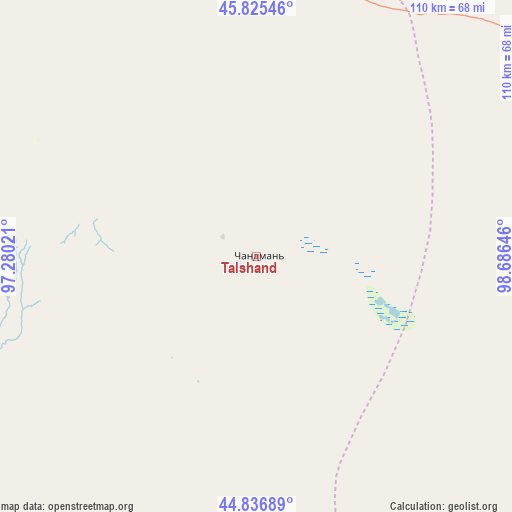
Talshand GPS coordinates[2]
45° 19' 59.988" North, 97° 58' 59.988" East
| Map corner | latitude | longitude |
|---|---|---|
| Upper-left | 45.82546°, | 97.28021° |
| Center: | 45.33333°, | 97.98333° |
| Lower-right: | 44.83689°, | 98.68646° |
| Map W x H: | 109.9×109.9 km | = 68.3×68.3mi |
| max Lat: | 51.50725° ⇑88% North |
| Talshand: | 45.33333° |
| min Lat: | ⇓12% South 42.84199° |
| min Long | Talshand | max Long |
| 89.14358° | 97.98333° | 118.51014° |
| W 26.4%⇐ | ⇒73.6% E |
Elevation
Elevation of Talshand is 2283 m = 7490 ft, and this is 866.5 m = 2843 ft above average elevation for this country.
| Max E: |
2800 m = 9186 ft | 2.5% |
| Talshand | 2283 m 7490 ft | |
| Avg. | 1416.5 m = 4647 ft | |
Min E: |
619 m = 2031 ft | 97.5% |
See also: Mongolia elevation on elevation.city.
Geographical zone
Talshand is located in North temperate zone (between Tropic of Cancer and the Arctic Circle). Distance of this North polar circle is 2360.6 km =1466.8 mi to North.| Distance of | km | miles | from Talshand |
|---|---|---|---|
| North Pole | 4966.5 | 3086 | to North |
| Arctic Circle | 2360.6 | 1466.8 | to North |
| Tropic Cancer | 2434.7 | 1512.9 | to South |
| Equator | 5040.6 | 3132.1 | to South |


Nearby cities:
15 places around Talshand: (largest is in red/bold)
• Altai
176.6 km =109.7 mi,  310°
310°
• Balgatay
185.7 km =115.4 mi,  339°
339°
• Bayanbulag
164.4 km =102.2 mi,  2°
2°
• Bayansayr
115.8 km =72 mi,  77°
77°
• Bulgan
80.5 km =50 mi,  139°
139°
• Buyant
107.7 km =66.9 mi,  30°
30°
• Delgermörön
121.9 km =75.7 mi,  11°
11°
• Dzadgay
158.8 km =98.7 mi,  52°
52°
• Dzalaa
134.6 km =83.6 mi,  131°
131°
• Haliun
156.3 km =97.1 mi,  295°
295°
• Jargalant
75.5 km =46.9 mi, 303°
• Sangiyn Dalay
28.8 km =17.9 mi,  219°
219°
• Tahilt
104.6 km =65 mi,  270°
270°
• Taygan
123.1 km =76.5 mi, 337°
• Tseel
167.1 km =103.8 mi,  278°
278°
Sources, notices
• [Note1] Compared only with cities in Mongolia existing in our database
• [Src1] Map data: © OpenStreetMap contributors (CC-BY-SA)
• [Src2] Other city data from geonames.org with taken over terms of usage.
• [Src3] Geographical zone / Annual Mean Temperature by Robert A. Rohde @ Wikipedia
