San Pawl il-Baħar geodata
San Pawl il-Baħar (Saint Paul’s Bay) is a seat of a first-order administrative division; located in Malta in Europe/Malta (GMT+2) time zone. With population of 14,057 people, there are 4 cities with bigger population in this country. Compared to other cities in Malta, 74.6% of cities are located further ↓South; 67.6% of cities are located further →East and 88.7% of cities have higher elevation than San Pawl il-Baħar. Note1


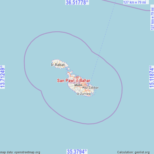
San Pawl il-Baħar GPS coordinates[2]
35° 57' 2.304" North, 14° 24' 56.196" East
| Map corner | latitude | longitude |
|---|---|---|
| Upper-left | 36.51778°, | 13.71249° |
| Center: | 35.95064°, | 14.41561° |
| Lower-right: | 35.3794°, | 15.11874° |
| Map W x H: | 126.6×126.6 km | = 78.7×78.7mi |
| max Lat: | 36.07222° ⇑25.4% North |
| San Pawl il-Baħar: | 35.95064° |
| min Lat: | ⇓74.6% South 35.82583° |
| min Long | San Pawl il-Ba� | max Long |
| 14.20361° | 14.41561° | 14.56701° |
| W 32.4%⇐ | ⇒67.6% E |
Elevation
Elevation of San Pawl il-Baħar is 22 m = 72 ft, and this is 56.1 m = 184 ft below average elevation for this country.
| Max E: |
231 m = 758 ft | 88.7% |
| Avg. | 78.1 m = 256 ft | |
| San Pawl il-Baħar | 22 m = 72 ft | |
Min E: |
5 m = 16 ft | 11.3% |
See also: Malta elevation on elevation.city.
Geographical zone
San Pawl il-Baħar is located in North temperate zone (between Tropic of Cancer and the Arctic Circle). Distance of this Northern Tropic circle is 1391.4 km =864.6 mi to South.| Distance of | km | miles | from San Pawl il-Baħar |
|---|---|---|---|
| North Pole | 6009.7 | 3734.3 | to North |
| Arctic Circle | 3403.8 | 2115 | to North |
| Tropic Cancer | 1391.4 | 864.6 | to South |
| Equator | 3997.3 | 2483.8 | to South |


Nearby cities:
15 places around San Pawl il-Baħar: (largest is in red/bold)
• Attard
7.2 km =4.5 mi,  160°
160°
• Balzan
6.6 km =4.1 mi,  147°
147°
• Birkirkara
7.2 km =4.5 mi, 145°
• Hal Gharghur
4.4 km =2.7 mi,  132°
132°
• Imdina
7.2 km =4.5 mi,  189°
189°
• Imtarfa
6.5 km =4 mi, 193°
• Imġarr
5.6 km =3.5 mi,  232°
232°
• L-Iklin
6.2 km =3.9 mi, 146°
• Lija
6.2 km =3.9 mi, 153°
• Mellieħa
4.8 km =3 mi,  277°
277°
• Mosta
4.7 km =2.9 mi,  169°
169°
• Naxxar
4.8 km =3 mi, 148°
• Pembroke
5.9 km =3.7 mi,  112°
112°
• Sprachcaffe
6.3 km =3.9 mi,  116°
116°
• Swieqi
6.6 km =4.1 mi, 118°
Sources, notices
• [Note1] Compared only with cities in Malta existing in our database
• [Src1] Map data: © OpenStreetMap contributors (CC-BY-SA)
• [Src2] Other city data from geonames.org with taken over terms of usage.
• [Src3] Geographical zone / Annual Mean Temperature by Robert A. Rohde @ Wikipedia
