El Abra (San Felipe) geodata
El Abra (San Felipe) (San Luis Potosí) is a populated place; located in Mexico in America/Mexico_City (GMT-6) time zone. With population of 734 people, there are 11902 cities with bigger population in this country. Compared to other cities in Mexico, 84% of cities are located further ↓South; 51.6% of cities are located further ←West and 76.7% of cities have higher elevation than El Abra (San Felipe). Note1
Current local time in El Abra (San Felipe):
08:32 AM, WednesdayDifference from your time zone: hours


El Abra (San Felipe) GPS coordinates[2]
21° 58' 29.856" North, 98° 55' 18.984" West
| Map corner | latitude | longitude |
|---|---|---|
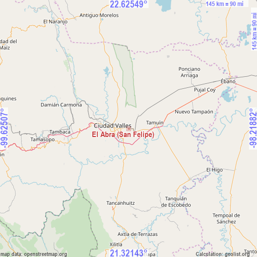
| Upper-left | 22.62549°, | -99.62507° |
| Center: | 21.97496°, | -98.92194° |
| Lower-right: | 21.32143°, | -98.21882° |
| Map W x H: | 145×145 km | = 90.1×90.1mi |
| max Lat: | 32.7° ⇑16% North |
| El Abra (San Felipe): | 21.97496° |
| min Lat: | ⇓84% South 14.53588° |
| min Long | El Abra (San Fe | max Long |
| -117.105° | -98.92194° | -86.73105° |
| W 51.6%⇐ | ⇒48.4% E |
Elevation
Elevation of El Abra (San Felipe) is 161 m = 528 ft, and this is 1092.7 m = 3585 ft below average elevation for this country.
| Max E: |
3497 m = 11473 ft | 76.7% |
| Avg. | 1253.7 m = 4113 ft | |
| El Abra (San Felipe) | 161 m = 528 ft | |
Min E: |
-1 m = -3 ft | 23.3% |
See also: Mexico elevation on elevation.city.
Geographical zone
El Abra (San Felipe) is located in North Torrid zone (between Equator and Tropic of Cancer). Distance of this Northern Tropic circle is 162.5 km =101 mi to North.| Distance of | km | miles | from El Abra (San Felipe) |
|---|---|---|---|
| North Pole | 7563.7 | 4699.9 | to North |
| Arctic Circle | 4957.8 | 3080.6 | to North |
| Tropic Cancer | 162.5 | 101 | to North |
| Equator | 2443.4 | 1518.3 | to South |


Nearby cities:
15 places around El Abra (San Felipe): (largest is in red/bold)
• Antiguo Tamuín
16.2 km =10.1 mi,  83°
83°
• Ciudad Valles
9.5 km =5.9 mi,  284°
284°
• El Ojite
20 km =12.4 mi,  268°
268°
• Estación Tamuín
16.1 km =10 mi,  45°
45°
• La Calera
9.6 km =6 mi,  197°
197°
• La Fortaleza
12.9 km =8 mi,  93°
93°
• La Lima
19.4 km =12.1 mi,  254°
254°
• La Subida
19.8 km =12.3 mi, 246°
• Las Palmas
8.2 km =5.1 mi,  37°
37°
• Los Sabinos Número Dos
15 km =9.3 mi,  337°
337°
• Nueva Primavera
9.5 km =5.9 mi,  135°
135°
• Ojo de Agua
19.9 km =12.4 mi, 265°
• San Antonio Huichimal
19.4 km =12.1 mi,  258°
258°
• San Felipe
1.2 km =0.7 mi,  293°
293°
• Tamuín
15.1 km =9.4 mi, 76°
Sources, notices
• [Note1] Compared only with cities in Mexico existing in our database
• [Src1] Map data: © OpenStreetMap contributors (CC-BY-SA)
• [Src2] Other city data from geonames.org with taken over terms of usage.
• [Src3] Geographical zone / Annual Mean Temperature by Robert A. Rohde @ Wikipedia
