San Felipe geodata
San Felipe (San Luis Potosí) is a populated place; located in Mexico in America/Mexico_City (GMT-6) time zone. With population of 851 people, there are 10275 cities with bigger population in this country. Compared to other cities in Mexico, 84.1% of cities are located further ↓South; 51.4% of cities are located further ←West and 76.6% of cities have higher elevation than San Felipe. Note1


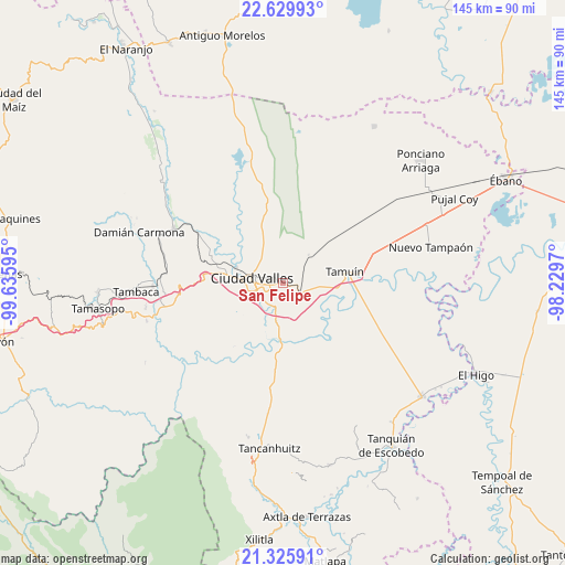
San Felipe GPS coordinates[2]
21° 58' 45.912" North, 98° 55' 58.152" West
| Map corner | latitude | longitude |
|---|---|---|
| Upper-left | 22.62993°, | -99.63595° |
| Center: | 21.97942°, | -98.93282° |
| Lower-right: | 21.32591°, | -98.2297° |
| Map W x H: | 145×145 km | = 90.1×90.1mi |
| max Lat: | 32.7° ⇑15.9% North |
| San Felipe: | 21.97942° |
| min Lat: | ⇓84.1% South 14.53588° |
| min Long | San Felipe | max Long |
| -117.105° | -98.93282° | -86.73105° |
| W 51.4%⇐ | ⇒48.6% E |
Elevation
Elevation of San Felipe is 164 m = 538 ft, and this is 1089.7 m = 3575 ft below average elevation for this country.
| Max E: |
3497 m = 11473 ft | 76.6% |
| Avg. | 1253.7 m = 4113 ft | |
| San Felipe | 164 m = 538 ft | |
Min E: |
-1 m = -3 ft | 23.4% |
See also: Mexico elevation on elevation.city.
Geographical zone
San Felipe is located in North Torrid zone (between Equator and Tropic of Cancer). Distance of this Northern Tropic circle is 162 km =100.7 mi to North.| Distance of | km | miles | from San Felipe |
|---|---|---|---|
| North Pole | 7563.2 | 4699.6 | to North |
| Arctic Circle | 4957.3 | 3080.3 | to North |
| Tropic Cancer | 162 | 100.7 | to North |
| Equator | 2443.9 | 1518.6 | to South |


Nearby cities:
15 places around San Felipe: (largest is in red/bold)
• Antiguo Tamuín
17.2 km =10.7 mi,  85°
85°
• Ciudad Valles
8.3 km =5.2 mi,  283°
283°
• El Abra (San Felipe)
1.2 km =0.7 mi,  113°
113°
• El Ojite
18.9 km =11.7 mi,  266°
266°
• Estación Tamuín
16.6 km =10.3 mi,  48°
48°
• La Calera
9.8 km =6.1 mi,  190°
190°
• La Fortaleza
14 km =8.7 mi,  95°
95°
• La Lima
18.5 km =11.5 mi,  251°
251°
• La Subida
19 km =11.8 mi,  244°
244°
• Las Palmas
8.5 km =5.3 mi, 45°
• Los Sabinos Número Dos
14.1 km =8.8 mi,  341°
341°
• Nueva Primavera
10.7 km =6.6 mi,  133°
133°
• Ojo de Agua
18.8 km =11.7 mi,  263°
263°
• San Antonio Huichimal
18.5 km =11.5 mi, 255°
• Tamuín
16 km =9.9 mi,  79°
79°
Sources, notices
• [Note1] Compared only with cities in Mexico existing in our database
• [Src1] Map data: © OpenStreetMap contributors (CC-BY-SA)
• [Src2] Other city data from geonames.org with taken over terms of usage.
• [Src3] Geographical zone / Annual Mean Temperature by Robert A. Rohde @ Wikipedia
