La Fortaleza geodata
La Fortaleza (San Luis Potosí) is a populated place; located in Mexico in America/Mexico_City (GMT-6) time zone. With population of 752 people, there are 11651 cities with bigger population in this country. Compared to other cities in Mexico, 84% of cities are located further ↓South; 53.7% of cities are located further ←West and 84.3% of cities have higher elevation than La Fortaleza. Note1


La Fortaleza GPS coordinates[2]
21° 58' 4.26" North, 98° 47' 50.784" West
| Map corner | latitude | longitude |
|---|---|---|
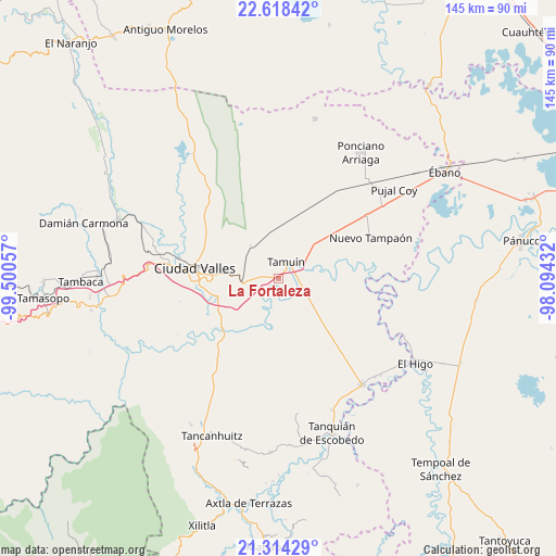
| Upper-left | 22.61842°, | -99.50057° |
| Center: | 21.96785°, | -98.79744° |
| Lower-right: | 21.31429°, | -98.09432° |
| Map W x H: | 145×145 km | = 90.1×90.1mi |
| max Lat: | 32.7° ⇑16% North |
| La Fortaleza: | 21.96785° |
| min Lat: | ⇓84% South 14.53588° |
| min Long | La Fortaleza | max Long |
| -117.105° | -98.79744° | -86.73105° |
| W 53.7%⇐ | ⇒46.3% E |
Elevation
Elevation of La Fortaleza is 49 m = 161 ft, and this is 1204.7 m = 3952 ft below average elevation for this country.
| Max E: |
3497 m = 11473 ft | 84.3% |
| Avg. | 1253.7 m = 4113 ft | |
| La Fortaleza | 49 m = 161 ft | |
Min E: |
-1 m = -3 ft | 15.7% |
See also: Mexico elevation on elevation.city.
Geographical zone
La Fortaleza is located in North Torrid zone (between Equator and Tropic of Cancer). Distance of this Northern Tropic circle is 163.3 km =101.5 mi to North.| Distance of | km | miles | from La Fortaleza |
|---|---|---|---|
| North Pole | 7564.5 | 4700.4 | to North |
| Arctic Circle | 4958.6 | 3081.1 | to North |
| Tropic Cancer | 163.3 | 101.5 | to North |
| Equator | 2442.6 | 1517.8 | to South |


Nearby cities:
15 places around La Fortaleza: (largest is in red/bold)
• Antiguo Tamuín
4.1 km =2.5 mi,  50°
50°
• Ciudad Valles
22.2 km =13.8 mi,  278°
278°
• Ejido los Huastecos
15.2 km =9.4 mi,  93°
93°
• El Abra (San Felipe)
12.9 km =8 mi,  273°
273°
• El Carrizo
20.5 km =12.7 mi,  175°
175°
• El Centinela
18.8 km =11.7 mi, 51°
• Emiliano Zapata
23 km =14.3 mi,  351°
351°
• Estación Tamuín
12.3 km =7.6 mi, 353°
• La Calera
17.8 km =11.1 mi,  242°
242°
• Las Palmas
10.7 km =6.6 mi,  312°
312°
• Los Sabinos Número Dos
23.6 km =14.7 mi, 308°
• Nueva Primavera
8.7 km =5.4 mi,  225°
225°
• Nuevo Ahuacatitla
15.9 km =9.9 mi,  106°
106°
• San Felipe
14 km =8.7 mi, 275°
• Tamuín
4.6 km =2.9 mi,  23°
23°
Sources, notices
• [Note1] Compared only with cities in Mexico existing in our database
• [Src1] Map data: © OpenStreetMap contributors (CC-BY-SA)
• [Src2] Other city data from geonames.org with taken over terms of usage.
• [Src3] Geographical zone / Annual Mean Temperature by Robert A. Rohde @ Wikipedia
