Plan de Iguala geodata
Plan de Iguala (Veracruz) is a populated place; located in Mexico in America/Mexico_City (GMT-6) time zone. With population of 1,596 people, there are 5414 cities with bigger population in this country. Compared to other cities in Mexico, 84.4% of cities are located further ↓South; 57.7% of cities are located further ←West and 91.2% of cities have higher elevation than Plan de Iguala. Note1


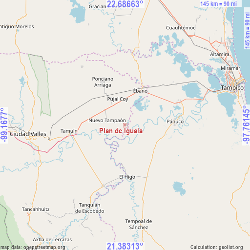
Plan de Iguala GPS coordinates[2]
22° 2' 10.968" North, 98° 27' 52.452" West
| Map corner | latitude | longitude |
|---|---|---|
| Upper-left | 22.68663°, | -99.1677° |
| Center: | 22.03638°, | -98.46457° |
| Lower-right: | 21.38313°, | -97.76145° |
| Map W x H: | 144.9×144.9 km | = 90×90mi |
| max Lat: | 32.7° ⇑15.6% North |
| Plan de Iguala: | 22.03638° |
| min Lat: | ⇓84.4% South 14.53588° |
| min Long | Plan de Iguala | max Long |
| -117.105° | -98.46457° | -86.73105° |
| W 57.7%⇐ | ⇒42.3% E |
Elevation
Elevation of Plan de Iguala is 21 m = 69 ft, and this is 1232.7 m = 4044 ft below average elevation for this country.
| Max E: |
3497 m = 11473 ft | 91.2% |
| Avg. | 1253.7 m = 4113 ft | |
| Plan de Iguala | 21 m = 69 ft | |
Min E: |
-1 m = -3 ft | 8.8% |
See also: Mexico elevation on elevation.city.
Geographical zone
Plan de Iguala is located in North Torrid zone (between Equator and Tropic of Cancer). Distance of this Northern Tropic circle is 155.7 km =96.7 mi to North.| Distance of | km | miles | from Plan de Iguala |
|---|---|---|---|
| North Pole | 7556.8 | 4695.6 | to North |
| Arctic Circle | 4951 | 3076.4 | to North |
| Tropic Cancer | 155.7 | 96.7 | to North |
| Equator | 2450.2 | 1522.5 | to South |


Nearby cities:
15 places around Plan de Iguala: (largest is in red/bold)
• Ejido la Reforma
2.1 km =1.3 mi,  180°
180°
• Ejido los Huastecos
21 km =13 mi,  245°
245°
• El Centinela
20 km =12.4 mi,  281°
281°
• El Chote
24.9 km =15.5 mi, 180°
• El Molino
21.7 km =13.5 mi,  128°
128°
• El Pueblito
26.3 km =16.3 mi, 178°
• Estación Velazco
20.1 km =12.5 mi,  329°
329°
• Nuevo Ahuacatitla
22.7 km =14.1 mi,  237°
237°
• Nuevo Tampaón
10.8 km =6.7 mi,  285°
285°
• Oviedo
6.7 km =4.2 mi,  81°
81°
• Ponciano Arriaga
28.2 km =17.5 mi, 332°
• Pujal-Coy
16.1 km =10 mi,  344°
344°
• Pánuco
28.9 km =18 mi,  86°
86°
• Reventadero
28.5 km =17.7 mi,  71°
71°
• Ébano
22.1 km =13.7 mi,  24°
24°
Sources, notices
• [Note1] Compared only with cities in Mexico existing in our database
• [Src1] Map data: © OpenStreetMap contributors (CC-BY-SA)
• [Src2] Other city data from geonames.org with taken over terms of usage.
• [Src3] Geographical zone / Annual Mean Temperature by Robert A. Rohde @ Wikipedia
