Nuevo Ahuacatitla geodata
Nuevo Ahuacatitla (San Luis Potosí) is a populated place; located in Mexico in America/Mexico_City (GMT-6) time zone. With population of 912 people, there are 9567 cities with bigger population in this country. Compared to other cities in Mexico, 83.7% of cities are located further ↓South; 55.6% of cities are located further ←West and 83.1% of cities have higher elevation than Nuevo Ahuacatitla. Note1


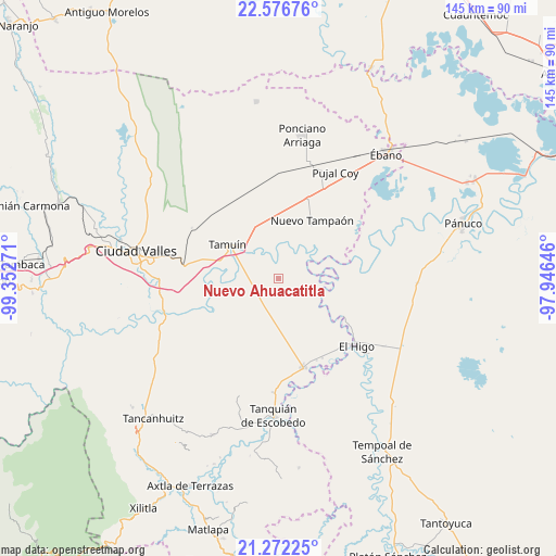
Nuevo Ahuacatitla GPS coordinates[2]
21° 55' 33.6" North, 98° 38' 58.488" West
| Map corner | latitude | longitude |
|---|---|---|
| Upper-left | 22.57676°, | -99.35271° |
| Center: | 21.926°, | -98.64958° |
| Lower-right: | 21.27225°, | -97.94646° |
| Map W x H: | 145×145 km | = 90.1×90.1mi |
| max Lat: | 32.7° ⇑16.3% North |
| Nuevo Ahuacatitla: | 21.926° |
| min Lat: | ⇓83.7% South 14.53588° |
| min Long | Nuevo Ahuacatit | max Long |
| -117.105° | -98.64958° | -86.73105° |
| W 55.6%⇐ | ⇒44.4% E |
Elevation
Elevation of Nuevo Ahuacatitla is 59 m = 194 ft, and this is 1194.7 m = 3920 ft below average elevation for this country.
| Max E: |
3497 m = 11473 ft | 83.1% |
| Avg. | 1253.7 m = 4113 ft | |
| Nuevo Ahuacatitla | 59 m = 194 ft | |
Min E: |
-1 m = -3 ft | 16.9% |
See also: Mexico elevation on elevation.city.
Geographical zone
Nuevo Ahuacatitla is located in North Torrid zone (between Equator and Tropic of Cancer). Distance of this Northern Tropic circle is 168 km =104.4 mi to North.| Distance of | km | miles | from Nuevo Ahuacatitla |
|---|---|---|---|
| North Pole | 7569.1 | 4703.2 | to North |
| Arctic Circle | 4963.2 | 3084 | to North |
| Tropic Cancer | 168 | 104.4 | to North |
| Equator | 2437.9 | 1514.8 | to South |


Nearby cities:
15 places around Nuevo Ahuacatitla: (largest is in red/bold)
• Antiguo Tamuín
14.1 km =8.8 mi,  301°
301°
• Ejido la Reforma
21.6 km =13.4 mi,  61°
61°
• Ejido los Huastecos
3.7 km =2.3 mi,  358°
358°
• El Carrizo
20.8 km =12.9 mi,  220°
220°
• El Centinela
16.4 km =10.2 mi, 358°
• El Chote
22.6 km =14 mi,  123°
123°
• El Sasub
23.6 km =14.7 mi,  151°
151°
• El Álamo
23.4 km =14.5 mi,  155°
155°
• Estación Tamuín
23.7 km =14.7 mi,  315°
315°
• La Fortaleza
15.9 km =9.9 mi,  286°
286°
• Nueva Primavera
21.5 km =13.4 mi,  266°
266°
• Nuevo Tampaón
17.5 km =10.9 mi,  29°
29°
• Plan de Iguala
22.7 km =14.1 mi, 57°
• San Francisco Cuayalab
22.6 km =14 mi,  198°
198°
• Tamuín
16.1 km =10 mi, 303°
Sources, notices
• [Note1] Compared only with cities in Mexico existing in our database
• [Src1] Map data: © OpenStreetMap contributors (CC-BY-SA)
• [Src2] Other city data from geonames.org with taken over terms of usage.
• [Src3] Geographical zone / Annual Mean Temperature by Robert A. Rohde @ Wikipedia
