Ejido los Huastecos geodata
Ejido los Huastecos (San Luis Potosí) is a populated place; located in Mexico in America/Mexico_City (GMT-6) time zone. With population of 1,380 people, there are 6280 cities with bigger population in this country. Compared to other cities in Mexico, 83.9% of cities are located further ↓South; 55.6% of cities are located further ←West and 86.1% of cities have higher elevation than Ejido los Huastecos. Note1


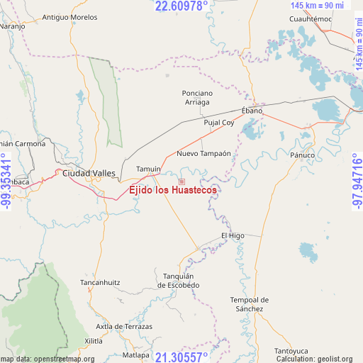
Ejido los Huastecos GPS coordinates[2]
21° 57' 33.012" North, 98° 39' 1.008" West
| Map corner | latitude | longitude |
|---|---|---|
| Upper-left | 22.60978°, | -99.35341° |
| Center: | 21.95917°, | -98.65028° |
| Lower-right: | 21.30557°, | -97.94716° |
| Map W x H: | 145×145 km | = 90.1×90.1mi |
| max Lat: | 32.7° ⇑16.1% North |
| Ejido los Huastecos: | 21.95917° |
| min Lat: | ⇓83.9% South 14.53588° |
| min Long | Ejido los Huast | max Long |
| -117.105° | -98.65028° | -86.73105° |
| W 55.6%⇐ | ⇒44.4% E |
Elevation
Elevation of Ejido los Huastecos is 38 m = 125 ft, and this is 1215.7 m = 3989 ft below average elevation for this country.
| Max E: |
3497 m = 11473 ft | 86.1% |
| Avg. | 1253.7 m = 4113 ft | |
| Ejido los Huastecos | 38 m = 125 ft | |
Min E: |
-1 m = -3 ft | 13.9% |
See also: Mexico elevation on elevation.city.
Geographical zone
Ejido los Huastecos is located in North Torrid zone (between Equator and Tropic of Cancer). Distance of this Northern Tropic circle is 164.3 km =102.1 mi to North.| Distance of | km | miles | from Ejido los Huastecos |
|---|---|---|---|
| North Pole | 7565.4 | 4700.9 | to North |
| Arctic Circle | 4959.5 | 3081.7 | to North |
| Tropic Cancer | 164.3 | 102.1 | to North |
| Equator | 2441.6 | 1517.1 | to South |


Nearby cities:
15 places around Ejido los Huastecos: (largest is in red/bold)
• Antiguo Tamuín
12.5 km =7.8 mi,  286°
286°
• Ejido la Reforma
20.2 km =12.6 mi,  71°
71°
• El Carrizo
23.7 km =14.7 mi,  214°
214°
• El Centinela
12.7 km =7.9 mi,  358°
358°
• El Chote
24.9 km =15.5 mi,  130°
130°
• El Pueblito
26.7 km =16.6 mi, 131°
• Estación Tamuín
21.2 km =13.2 mi,  308°
308°
• La Fortaleza
15.2 km =9.4 mi,  273°
273°
• Las Palmas
24.5 km =15.2 mi, 289°
• Nueva Primavera
22 km =13.7 mi,  256°
256°
• Nuevo Ahuacatitla
3.7 km =2.3 mi,  178°
178°
• Nuevo Tampaón
14.4 km =8.9 mi,  37°
37°
• Plan de Iguala
21 km =13 mi, 65°
• San Francisco Cuayalab
26.1 km =16.2 mi,  195°
195°
• Tamuín
14.3 km =8.9 mi, 291°
Sources, notices
• [Note1] Compared only with cities in Mexico existing in our database
• [Src1] Map data: © OpenStreetMap contributors (CC-BY-SA)
• [Src2] Other city data from geonames.org with taken over terms of usage.
• [Src3] Geographical zone / Annual Mean Temperature by Robert A. Rohde @ Wikipedia
