Yobain geodata
Yobain (Yucatán) is a populated place; located in Mexico in America/Merida (GMT-6) time zone. With population of 1,820 people, there are 4784 cities with bigger population in this country. Compared to other cities in Mexico, 79.5% of cities are located further ↓South; 98.6% of cities are located further ←West and 97% of cities have higher elevation than Yobain. Note1


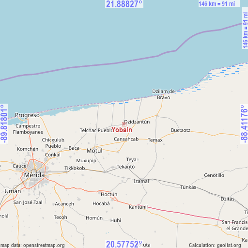
Yobain GPS coordinates[2]
21° 14' 3.66" North, 89° 6' 53.568" West
| Map corner | latitude | longitude |
|---|---|---|
| Upper-left | 21.88827°, | -89.81801° |
| Center: | 21.23435°, | -89.11488° |
| Lower-right: | 20.57752°, | -88.41176° |
| Map W x H: | 145.7×145.7 km | = 90.5×90.5mi |
| max Lat: | 32.7° ⇑20.5% North |
| Yobain: | 21.23435° |
| min Lat: | ⇓79.5% South 14.53588° |
| min Long | Yobain | max Long |
| -117.105° | -89.11488° | -86.73105° |
| W 98.6%⇐ | ⇒1.4% E |
Elevation
Elevation of Yobain is 10 m = 33 ft, and this is 1243.7 m = 4080 ft below average elevation for this country.
| Max E: |
3497 m = 11473 ft | 97% |
| Avg. | 1253.7 m = 4113 ft | |
| Yobain | 10 m = 33 ft | |
Min E: |
-1 m = -3 ft | 3% |
See also: Mexico elevation on elevation.city.
Geographical zone
Yobain is located in North Torrid zone (between Equator and Tropic of Cancer). Distance of this Northern Tropic circle is 244.9 km =152.2 mi to North.| Distance of | km | miles | from Yobain |
|---|---|---|---|
| North Pole | 7646 | 4751 | to North |
| Arctic Circle | 5040.1 | 3131.8 | to North |
| Tropic Cancer | 244.9 | 152.2 | to North |
| Equator | 2361 | 1467.1 | to South |


Nearby cities:
15 places around Yobain: (largest is in red/bold)
• Cansahcab
8.7 km =5.4 mi,  170°
170°
• Dzidzantun
7.7 km =4.8 mi,  77°
77°
• Dzilam González
19.9 km =12.4 mi,  74°
74°
• Kancabal
20.4 km =12.7 mi,  227°
227°
• Mesatunych
19.8 km =12.3 mi,  207°
207°
• San Crisanto
14.6 km =9.1 mi,  334°
334°
• San Francisco Manzanilla
9.7 km =6 mi, 78°
• San Pedro Chacabal
13.7 km =8.5 mi,  216°
216°
• Sinanche
7.3 km =4.5 mi,  262°
262°
• Suma de Hidalgo
16.8 km =10.4 mi,  191°
191°
• Tanya
19.4 km =12.1 mi, 225°
• Telchac Pueblo
16.4 km =10.2 mi, 257°
• Telchac Puerto
19.4 km =12.1 mi,  307°
307°
• Temax
20.3 km =12.6 mi,  117°
117°
• Uci
19.9 km =12.4 mi, 233°
Sources, notices
• [Note1] Compared only with cities in Mexico existing in our database
• [Src1] Map data: © OpenStreetMap contributors (CC-BY-SA)
• [Src2] Other city data from geonames.org with taken over terms of usage.
• [Src3] Geographical zone / Annual Mean Temperature by Robert A. Rohde @ Wikipedia
