San Juán Lachigalla geodata
San Juán Lachigalla (Oaxaca) is a seat of a second-order administrative division; located in Mexico in America/Mexico_City (GMT-6) time zone. With population of 1,077 people, there are 8093 cities with bigger population in this country. Compared to other cities in Mexico, 93.7% of cities are located further ↑North; 79.4% of cities are located further ←West and 58.1% of cities have lower elevation than San Juán Lachigalla. Note1


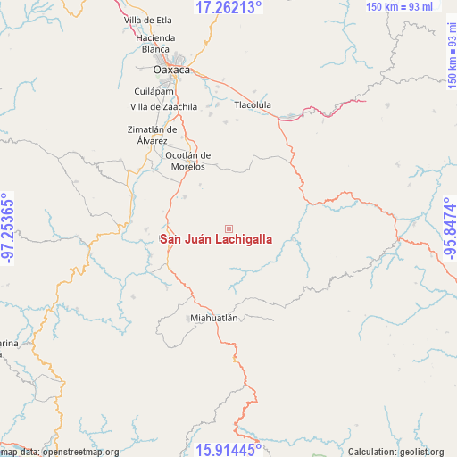
San Juán Lachigalla GPS coordinates[2]
16° 35' 22.092" North, 96° 33' 1.872" West
| Map corner | latitude | longitude |
|---|---|---|
| Upper-left | 17.26213°, | -97.25365° |
| Center: | 16.58947°, | -96.55052° |
| Lower-right: | 15.91445°, | -95.8474° |
| Map W x H: | 149.8×149.9 km | = 93.1×93.1mi |
| max Lat: | 32.7° ⇑93.7% North |
| San Juán Lachigalla: | 16.58947° |
| min Lat: | ⇓6.3% South 14.53588° |
| min Long | San Juán Lachi | max Long |
| -117.105° | -96.55052° | -86.73105° |
| W 79.4%⇐ | ⇒20.6% E |
Elevation
Elevation of San Juán Lachigalla is 1693 m = 5554 ft, and this is 439.3 m = 1441 ft above average elevation for this country.
| Max E: |
3497 m = 11473 ft | 41.9% |
| San Juán Lachigalla | 1693 m 5554 ft | |
| Avg. | 1253.7 m = 4113 ft | |
Min E: |
-1 m = -3 ft | 58.1% |
See also: Mexico elevation on elevation.city.
Geographical zone
San Juán Lachigalla is located in North Torrid zone (between Equator and Tropic of Cancer). Distance of this Northern Tropic circle is 761.3 km =473 mi to North.| Distance of | km | miles | from San Juán Lachigalla |
|---|---|---|---|
| North Pole | 8162.5 | 5071.9 | to North |
| Arctic Circle | 5556.6 | 3452.7 | to North |
| Tropic Cancer | 761.3 | 473 | to North |
| Equator | 1844.6 | 1146.2 | to South |


Nearby cities:
15 places around San Juán Lachigalla: (largest is in red/bold)
• Coatecas Altas
13.8 km =8.6 mi,  246°
246°
• Ejutla de Crespo
19.4 km =12.1 mi,  262°
262°
• El Cerro de las Huertas
16.3 km =10.1 mi, 260°
• La Escalera
14.6 km =9.1 mi,  203°
203°
• Los Ocotes
18.3 km =11.4 mi,  278°
278°
• Maguey Largo
15.4 km =9.6 mi,  312°
312°
• Praxedis de Guerrero
17.4 km =10.8 mi,  326°
326°
• San Esteban Amatlán
9.5 km =5.9 mi,  179°
179°
• San Jerónimo Taviche
14.7 km =9.1 mi,  341°
341°
• San José del Progreso
17.9 km =11.1 mi, 307°
• San José la Garzona
13.8 km =8.6 mi,  317°
317°
• San Pedro Taviche
5.7 km =3.5 mi,  14°
14°
• Santa María Velato
13.8 km =8.6 mi,  226°
226°
• Santiago la Libertad
3.6 km =2.2 mi,  146°
146°
• Yaxe
17.3 km =10.7 mi,  28°
28°
Sources, notices
• [Note1] Compared only with cities in Mexico existing in our database
• [Src1] Map data: © OpenStreetMap contributors (CC-BY-SA)
• [Src2] Other city data from geonames.org with taken over terms of usage.
• [Src3] Geographical zone / Annual Mean Temperature by Robert A. Rohde @ Wikipedia
