Santiago la Libertad geodata
Santiago la Libertad (Oaxaca) is a populated place; located in Mexico in America/Mexico_City (GMT-6) time zone. With population of 520 people, there are 16208 cities with bigger population in this country. Compared to other cities in Mexico, 93.9% of cities are located further ↑North; 79.5% of cities are located further ←West and 59.7% of cities have lower elevation than Santiago la Libertad. Note1


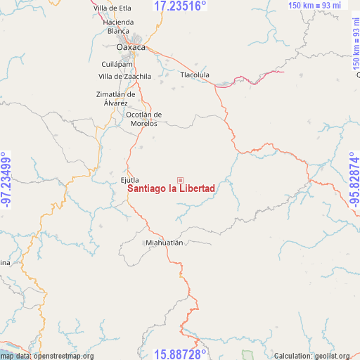
Santiago la Libertad GPS coordinates[2]
16° 33' 44.64" North, 96° 31' 54.696" West
| Map corner | latitude | longitude |
|---|---|---|
| Upper-left | 17.23516°, | -97.23499° |
| Center: | 16.5624°, | -96.53186° |
| Lower-right: | 15.88728°, | -95.82874° |
| Map W x H: | 149.9×149.9 km | = 93.1×93.1mi |
| max Lat: | 32.7° ⇑93.9% North |
| Santiago la Libertad: | 16.5624° |
| min Lat: | ⇓6.1% South 14.53588° |
| min Long | Santiago la Lib | max Long |
| -117.105° | -96.53186° | -86.73105° |
| W 79.5%⇐ | ⇒20.5% E |
Elevation
Elevation of Santiago la Libertad is 1721 m = 5646 ft, and this is 467.3 m = 1533 ft above average elevation for this country.
| Max E: |
3497 m = 11473 ft | 40.3% |
| Santiago la Libertad | 1721 m 5646 ft | |
| Avg. | 1253.7 m = 4113 ft | |
Min E: |
-1 m = -3 ft | 59.7% |
See also: Mexico elevation on elevation.city.
Geographical zone
Santiago la Libertad is located in North Torrid zone (between Equator and Tropic of Cancer). Distance of this Northern Tropic circle is 764.4 km =475 mi to North.| Distance of | km | miles | from Santiago la Libertad |
|---|---|---|---|
| North Pole | 8165.5 | 5073.8 | to North |
| Arctic Circle | 5559.6 | 3454.6 | to North |
| Tropic Cancer | 764.4 | 475 | to North |
| Equator | 1841.6 | 1144.3 | to South |


Nearby cities:
15 places around Santiago la Libertad: (largest is in red/bold)
• Coatecas Altas
14.8 km =9.2 mi,  260°
260°
• El Cerro de las Huertas
18 km =11.2 mi,  271°
271°
• El Zompantle
19.8 km =12.3 mi,  227°
227°
• La Escalera
13 km =8.1 mi,  216°
216°
• La Soledad
18.2 km =11.3 mi,  211°
211°
• Maguey Largo
18.9 km =11.7 mi,  315°
315°
• San Esteban Amatlán
6.7 km =4.2 mi,  196°
196°
• San Jerónimo Taviche
18.2 km =11.3 mi,  338°
338°
• San José la Garzona
17.3 km =10.7 mi, 319°
• San Juán Lachigalla
3.6 km =2.2 mi,  326°
326°
• San Luis Amatlán
19.9 km =12.4 mi,  169°
169°
• San Pedro Taviche
8.5 km =5.3 mi,  356°
356°
• Santa María Velato
13.7 km =8.5 mi,  241°
241°
• Santa María Zoquitlán
19 km =11.8 mi,  91°
91°
• Yaxe
19.3 km =12 mi,  19°
19°
Sources, notices
• [Note1] Compared only with cities in Mexico existing in our database
• [Src1] Map data: © OpenStreetMap contributors (CC-BY-SA)
• [Src2] Other city data from geonames.org with taken over terms of usage.
• [Src3] Geographical zone / Annual Mean Temperature by Robert A. Rohde @ Wikipedia
