Xitlama geodata
Xitlama (Puebla) is a populated place; located in Mexico in America/Mexico_City (GMT-6) time zone. With population of 3,198 people, there are 2828 cities with bigger population in this country. Compared to other cities in Mexico, 74.8% of cities are located further ↑North; 74.6% of cities are located further ←West and 66.5% of cities have lower elevation than Xitlama. Note1


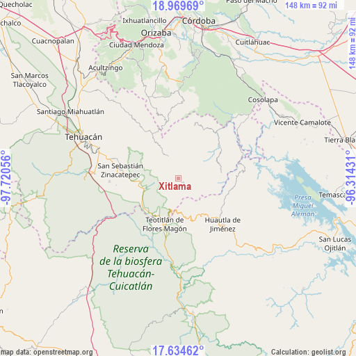
Xitlama GPS coordinates[2]
18° 18' 12.384" North, 97° 1' 2.748" West
| Map corner | latitude | longitude |
|---|---|---|
| Upper-left | 18.96969°, | -97.72056° |
| Center: | 18.30344°, | -97.01743° |
| Lower-right: | 17.63462°, | -96.31431° |
| Map W x H: | 148.4×148.4 km | = 92.2×92.2mi |
| max Lat: | 32.7° ⇑74.8% North |
| Xitlama: | 18.30344° |
| min Lat: | ⇓25.2% South 14.53588° |
| min Long | Xitlama | max Long |
| -117.105° | -97.01743° | -86.73105° |
| W 74.6%⇐ | ⇒25.4% E |
Elevation
Elevation of Xitlama is 1861 m = 6106 ft, and this is 607.3 m = 1992 ft above average elevation for this country.
| Max E: |
3497 m = 11473 ft | 33.5% |
| Xitlama | 1861 m 6106 ft | |
| Avg. | 1253.7 m = 4113 ft | |
Min E: |
-1 m = -3 ft | 66.5% |
See also: Mexico elevation on elevation.city.
Geographical zone
Xitlama is located in North Torrid zone (between Equator and Tropic of Cancer). Distance of this Northern Tropic circle is 570.8 km =354.7 mi to North.| Distance of | km | miles | from Xitlama |
|---|---|---|---|
| North Pole | 7971.9 | 4953.5 | to North |
| Arctic Circle | 5366 | 3334.3 | to North |
| Tropic Cancer | 570.8 | 354.7 | to North |
| Equator | 2035.2 | 1264.6 | to South |


Nearby cities:
15 places around Xitlama: (largest is in red/bold)
• Acatepec
7.9 km =4.9 mi,  345°
345°
• Cacaloc
10.3 km =6.4 mi,  302°
302°
• Chichicapa
11.2 km =7 mi,  343°
343°
• Chichiltepec
10.5 km =6.5 mi,  227°
227°
• Cinco Señores
9.9 km =6.2 mi,  319°
319°
• Coyomeapan
3.5 km =2.2 mi,  133°
133°
• Ocotlamanic
8.7 km =5.4 mi,  285°
285°
• San Juan Cuautla
9.2 km =5.7 mi,  135°
135°
• Segunda Sección
2.5 km =1.6 mi,  150°
150°
• Tecoltepec
6.9 km =4.3 mi, 290°
• Tepoxtla
7.3 km =4.5 mi,  159°
159°
• Tlixco
3.8 km =2.4 mi, 150°
• Zoquitlanzacualco
3.2 km =2 mi,  328°
328°
• Zoquitlán
3.5 km =2.2 mi,  359°
359°
• Ízhuapa
8.9 km =5.5 mi, 359°
Sources, notices
• [Note1] Compared only with cities in Mexico existing in our database
• [Src1] Map data: © OpenStreetMap contributors (CC-BY-SA)
• [Src2] Other city data from geonames.org with taken over terms of usage.
• [Src3] Geographical zone / Annual Mean Temperature by Robert A. Rohde @ Wikipedia
