Tlahuelilpan geodata
Tlahuelilpan (Hidalgo) is a populated place; located in Mexico in America/Mexico_City (GMT-6) time zone. With population of 8,498 people, there are 1121 cities with bigger population in this country. Compared to other cities in Mexico, 59.8% of cities are located further ↓South; 53.3% of cities are located further →East and 76.8% of cities have lower elevation than Tlahuelilpan. Note1


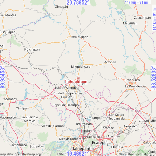
Tlahuelilpan GPS coordinates[2]
20° 7' 50.736" North, 99° 13' 53.22" West
| Map corner | latitude | longitude |
|---|---|---|
| Upper-left | 20.78952°, | -99.93458° |
| Center: | 20.13076°, | -99.23145° |
| Lower-right: | 19.46921°, | -98.52833° |
| Map W x H: | 146.8×146.8 km | = 91.2×91.2mi |
| max Lat: | 32.7° ⇑40.2% North |
| Tlahuelilpan: | 20.13076° |
| min Lat: | ⇓59.8% South 14.53588° |
| min Long | Tlahuelilpan | max Long |
| -117.105° | -99.23145° | -86.73105° |
| W 46.7%⇐ | ⇒53.3% E |
Elevation
Elevation of Tlahuelilpan is 2063 m = 6768 ft, and this is 809.3 m = 2655 ft above average elevation for this country.
| Max E: |
3497 m = 11473 ft | 23.2% |
| Tlahuelilpan | 2063 m 6768 ft | |
| Avg. | 1253.7 m = 4113 ft | |
Min E: |
-1 m = -3 ft | 76.8% |
See also: Mexico elevation on elevation.city.
Geographical zone
Tlahuelilpan is located in North Torrid zone (between Equator and Tropic of Cancer). Distance of this Northern Tropic circle is 367.6 km =228.4 mi to North.| Distance of | km | miles | from Tlahuelilpan |
|---|---|---|---|
| North Pole | 7768.7 | 4827.2 | to North |
| Arctic Circle | 5162.8 | 3208 | to North |
| Tropic Cancer | 367.6 | 228.4 | to North |
| Equator | 2238.3 | 1390.8 | to South |


Nearby cities:
15 places around Tlahuelilpan: (largest is in red/bold)
• Cañada
6.6 km =4.1 mi,  41°
41°
• Colonia Lázaro Cárdenas
1.8 km =1.1 mi,  327°
327°
• Doxey
4.5 km =2.8 mi,  196°
196°
• Huitel
6.4 km =4 mi,  309°
309°
• La Cruz
5.1 km =3.2 mi,  348°
348°
• La Loma
6.2 km =3.9 mi, 327°
• Mangas
6.4 km =4 mi,  344°
344°
• Motovatha
6.5 km =4 mi,  24°
24°
• Munitepec de Madero
3.3 km =2.1 mi,  94°
94°
• Presas
3.9 km =2.4 mi, 325°
• San Isidro el Tanque
7.6 km =4.7 mi, 310°
• Teltipán de Juárez
3.6 km =2.2 mi,  118°
118°
• Teocalco
7.3 km =4.5 mi,  227°
227°
• Tlalminulpa
6.3 km =3.9 mi,  171°
171°
• Tlaxcoapan
4.5 km =2.8 mi, 165°
Sources, notices
• [Note1] Compared only with cities in Mexico existing in our database
• [Src1] Map data: © OpenStreetMap contributors (CC-BY-SA)
• [Src2] Other city data from geonames.org with taken over terms of usage.
• [Src3] Geographical zone / Annual Mean Temperature by Robert A. Rohde @ Wikipedia
