Tixcacaltuyub geodata
Tixcacaltuyub (Yucatán) is a populated place; located in Mexico in America/Merida (GMT-6) time zone. With population of 2,146 people, there are 4088 cities with bigger population in this country. Compared to other cities in Mexico, 67.6% of cities are located further ↓South; 98.9% of cities are located further ←West and 90% of cities have higher elevation than Tixcacaltuyub. Note1


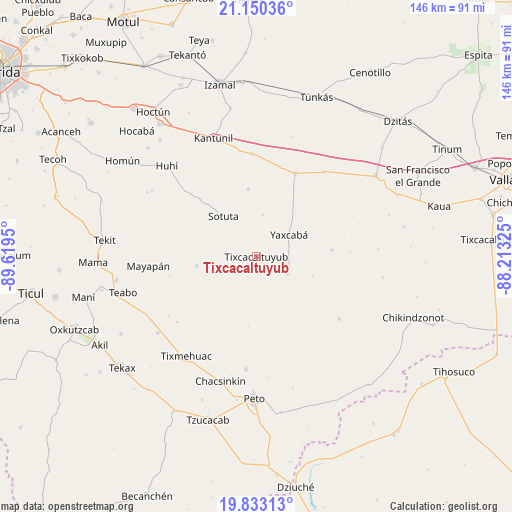
Tixcacaltuyub GPS coordinates[2]
20° 29' 35.376" North, 88° 54' 58.932" West
| Map corner | latitude | longitude |
|---|---|---|
| Upper-left | 21.15036°, | -89.6195° |
| Center: | 20.49316°, | -88.91637° |
| Lower-right: | 19.83313°, | -88.21325° |
| Map W x H: | 146.5×146.5 km | = 91×91mi |
| max Lat: | 32.7° ⇑32.4% North |
| Tixcacaltuyub: | 20.49316° |
| min Lat: | ⇓67.6% South 14.53588° |
| min Long | Tixcacaltuyub | max Long |
| -117.105° | -88.91637° | -86.73105° |
| W 98.9%⇐ | ⇒1.1% E |
Elevation
Elevation of Tixcacaltuyub is 24 m = 79 ft, and this is 1229.7 m = 4034 ft below average elevation for this country.
| Max E: |
3497 m = 11473 ft | 90% |
| Avg. | 1253.7 m = 4113 ft | |
| Tixcacaltuyub | 24 m = 79 ft | |
Min E: |
-1 m = -3 ft | 10% |
See also: Mexico elevation on elevation.city.
Geographical zone
Tixcacaltuyub is located in North Torrid zone (between Equator and Tropic of Cancer). Distance of this Northern Tropic circle is 327.3 km =203.4 mi to North.| Distance of | km | miles | from Tixcacaltuyub |
|---|---|---|---|
| North Pole | 7728.4 | 4802.2 | to North |
| Arctic Circle | 5122.5 | 3183 | to North |
| Tropic Cancer | 327.3 | 203.4 | to North |
| Equator | 2278.6 | 1415.9 | to South |


Nearby cities:
15 places around Tixcacaltuyub: (largest is in red/bold)
• Cantamayec
17.4 km =10.8 mi,  261°
261°
• Holca
29.3 km =18.2 mi,  357°
357°
• Kancabdzonot
21.5 km =13.4 mi,  85°
85°
• Kimbila
28.1 km =17.5 mi,  218°
218°
• Kinil
29.4 km =18.3 mi,  230°
230°
• Libre Unión
26.2 km =16.3 mi,  25°
25°
• Sabacché
22.9 km =14.2 mi,  210°
210°
• Sotuta
15 km =9.3 mi,  320°
320°
• Tabi
11.9 km =7.4 mi,  9°
9°
• Tahdzibichen
10.2 km =6.3 mi,  118°
118°
• Tibolón
19.3 km =12 mi,  352°
352°
• Timul
20.5 km =12.7 mi,  186°
186°
• Yaxcabá
11.1 km =6.9 mi,  56°
56°
• Yaxunah
25.6 km =15.9 mi,  77°
77°
• Zavala
24.4 km =15.2 mi,  302°
302°
Sources, notices
• [Note1] Compared only with cities in Mexico existing in our database
• [Src1] Map data: © OpenStreetMap contributors (CC-BY-SA)
• [Src2] Other city data from geonames.org with taken over terms of usage.
• [Src3] Geographical zone / Annual Mean Temperature by Robert A. Rohde @ Wikipedia
