Tepepa geodata
Tepepa (Hidalgo) is a populated place; located in Mexico in America/Mexico_City (GMT-6) time zone. With population of 4,830 people, there are 1917 cities with bigger population in this country. Compared to other cities in Mexico, 59.9% of cities are located further ↓South; 61.6% of cities are located further ←West and 82.2% of cities have lower elevation than Tepepa. Note1


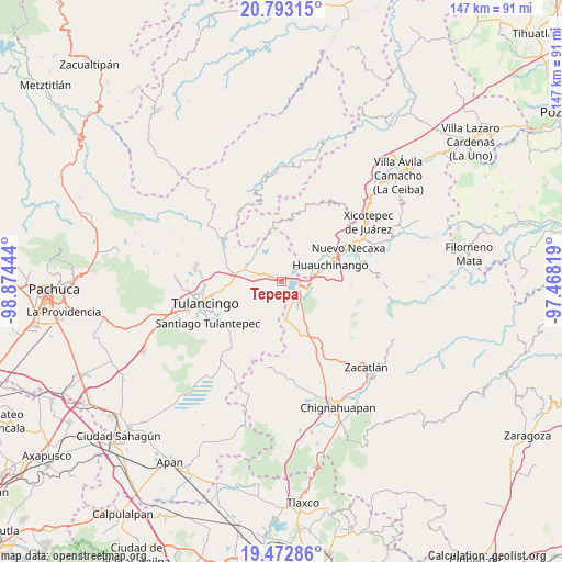
Tepepa GPS coordinates[2]
20° 8' 3.84" North, 98° 10' 16.716" West
| Map corner | latitude | longitude |
|---|---|---|
| Upper-left | 20.79315°, | -98.87444° |
| Center: | 20.1344°, | -98.17131° |
| Lower-right: | 19.47286°, | -97.46819° |
| Map W x H: | 146.8×146.8 km | = 91.2×91.2mi |
| max Lat: | 32.7° ⇑40.1% North |
| Tepepa: | 20.1344° |
| min Lat: | ⇓59.9% South 14.53588° |
| min Long | Tepepa | max Long |
| -117.105° | -98.17131° | -86.73105° |
| W 61.6%⇐ | ⇒38.4% E |
Elevation
Elevation of Tepepa is 2193 m = 7195 ft, and this is 939.3 m = 3082 ft above average elevation for this country.
| Max E: |
3497 m = 11473 ft | 17.8% |
| Tepepa | 2193 m 7195 ft | |
| Avg. | 1253.7 m = 4113 ft | |
Min E: |
-1 m = -3 ft | 82.2% |
See also: Mexico elevation on elevation.city.
Geographical zone
Tepepa is located in North Torrid zone (between Equator and Tropic of Cancer). Distance of this Northern Tropic circle is 367.2 km =228.2 mi to North.| Distance of | km | miles | from Tepepa |
|---|---|---|---|
| North Pole | 7768.3 | 4827 | to North |
| Arctic Circle | 5162.4 | 3207.8 | to North |
| Tropic Cancer | 367.2 | 228.2 | to North |
| Equator | 2238.7 | 1391.1 | to South |


Nearby cities:
15 places around Tepepa: (largest is in red/bold)
• Acaxochitlán
4.1 km =2.5 mi,  309°
309°
• Barrio Cuaunepantla
6.4 km =4 mi,  292°
292°
• Barrio Techachalco
5.5 km =3.4 mi, 305°
• Beristain
6 km =3.7 mi,  138°
138°
• Chimalapa
6.1 km =3.8 mi,  11°
11°
• Coyametepec
3.4 km =2.1 mi,  231°
231°
• El Tejocotal
4.6 km =2.9 mi,  82°
82°
• La Boveda
5 km =3.1 mi,  102°
102°
• Los Reyes
2.4 km =1.5 mi,  17°
17°
• Mesa de Capulines
6 km =3.7 mi,  114°
114°
• San Francisco Atotonilco
7 km =4.3 mi, 16°
• Tlacomulco
5.7 km =3.5 mi,  68°
68°
• Tlacpac
5 km =3.1 mi, 288°
• Tlaltegco (Venta Quemada)
2.4 km =1.5 mi,  298°
298°
• Tlatzintla
3.1 km =1.9 mi,  321°
321°
Sources, notices
• [Note1] Compared only with cities in Mexico existing in our database
• [Src1] Map data: © OpenStreetMap contributors (CC-BY-SA)
• [Src2] Other city data from geonames.org with taken over terms of usage.
• [Src3] Geographical zone / Annual Mean Temperature by Robert A. Rohde @ Wikipedia
