Tlaltegco (Venta Quemada) geodata
Tlaltegco (Venta Quemada) (Hidalgo) is a populated place; located in Mexico in America/Mexico_City (GMT-6) time zone. With population of 740 people, there are 11812 cities with bigger population in this country. Compared to other cities in Mexico, 60.1% of cities are located further ↓South; 61.4% of cities are located further ←West and 85.6% of cities have lower elevation than Tlaltegco (Venta Quemada). Note1
Current local time in Tlaltegco (Venta Quemada):
08:35 AM, WednesdayDifference from your time zone: hours


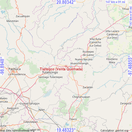
Tlaltegco (Venta Quemada) GPS coordinates[2]
20° 8' 40.992" North, 98° 11' 30.012" West
| Map corner | latitude | longitude |
|---|---|---|
| Upper-left | 20.80342°, | -98.8948° |
| Center: | 20.14472°, | -98.19167° |
| Lower-right: | 19.48323°, | -97.48855° |
| Map W x H: | 146.8×146.8 km | = 91.2×91.2mi |
| max Lat: | 32.7° ⇑39.9% North |
| Tlaltegco (Venta Quemada): | 20.14472° |
| min Lat: | ⇓60.1% South 14.53588° |
| min Long | Tlaltegco (Vent | max Long |
| -117.105° | -98.19167° | -86.73105° |
| W 61.4%⇐ | ⇒38.6% E |
Elevation
Elevation of Tlaltegco (Venta Quemada) is 2270 m = 7448 ft, and this is 1016.3 m = 3334 ft above average elevation for this country.
| Max E: |
3497 m = 11473 ft | 14.4% |
| Tlaltegco (Venta Quemada) | 2270 m 7448 ft | |
| Avg. | 1253.7 m = 4113 ft | |
Min E: |
-1 m = -3 ft | 85.6% |
See also: Mexico elevation on elevation.city.
Geographical zone
Tlaltegco (Venta Quemada) is located in North Torrid zone (between Equator and Tropic of Cancer). Distance of this Northern Tropic circle is 366 km =227.4 mi to North.| Distance of | km | miles | from Tlaltegco (Venta Quemada) |
|---|---|---|---|
| North Pole | 7767.2 | 4826.3 | to North |
| Arctic Circle | 5161.3 | 3207.1 | to North |
| Tropic Cancer | 366 | 227.4 | to North |
| Equator | 2239.9 | 1391.8 | to South |


Nearby cities:
15 places around Tlaltegco (Venta Quemada): (largest is in red/bold)
• Acaxochitlán
1.8 km =1.1 mi,  324°
324°
• Barrio Cuaunepantla
4 km =2.5 mi,  289°
289°
• Barrio Techachalco
3.1 km =1.9 mi,  310°
310°
• Chimalapa
5.8 km =3.6 mi,  34°
34°
• Coyametepec
3.3 km =2.1 mi,  189°
189°
• El Tejocotal
6.7 km =4.2 mi,  94°
94°
• La Boveda
7.3 km =4.5 mi,  107°
107°
• La Mesa
7.1 km =4.4 mi,  210°
210°
• Los Reyes
3.1 km =1.9 mi,  67°
67°
• San Francisco Atotonilco
7 km =4.3 mi,  36°
36°
• San Mateo
7.1 km =4.4 mi, 306°
• Santa Ana Tzacuala
6.1 km =3.8 mi,  347°
347°
• Tepepa
2.4 km =1.5 mi,  118°
118°
• Tlacpac
2.7 km =1.7 mi,  279°
279°
• Tlatzintla
1.3 km =0.8 mi,  9°
9°
Sources, notices
• [Note1] Compared only with cities in Mexico existing in our database
• [Src1] Map data: © OpenStreetMap contributors (CC-BY-SA)
• [Src2] Other city data from geonames.org with taken over terms of usage.
• [Src3] Geographical zone / Annual Mean Temperature by Robert A. Rohde @ Wikipedia
