El Tejocotal geodata
El Tejocotal (Hidalgo) is a populated place; located in Mexico in America/Mexico_City (GMT-6) time zone. With population of 861 people, there are 10161 cities with bigger population in this country. Compared to other cities in Mexico, 60% of cities are located further ↓South; 62.2% of cities are located further ←West and 80.1% of cities have lower elevation than El Tejocotal. Note1


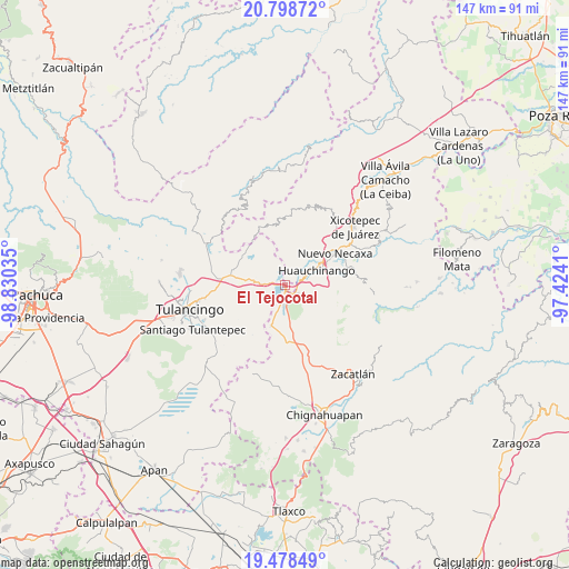
El Tejocotal GPS coordinates[2]
20° 8' 24" North, 98° 7' 37.992" West
| Map corner | latitude | longitude |
|---|---|---|
| Upper-left | 20.79872°, | -98.83035° |
| Center: | 20.14°, | -98.12722° |
| Lower-right: | 19.47849°, | -97.4241° |
| Map W x H: | 146.8×146.8 km | = 91.2×91.2mi |
| max Lat: | 32.7° ⇑40% North |
| El Tejocotal: | 20.14° |
| min Lat: | ⇓60% South 14.53588° |
| min Long | El Tejocotal | max Long |
| -117.105° | -98.12722° | -86.73105° |
| W 62.2%⇐ | ⇒37.8% E |
Elevation
Elevation of El Tejocotal is 2142 m = 7028 ft, and this is 888.3 m = 2914 ft above average elevation for this country.
| Max E: |
3497 m = 11473 ft | 19.9% |
| El Tejocotal | 2142 m 7028 ft | |
| Avg. | 1253.7 m = 4113 ft | |
Min E: |
-1 m = -3 ft | 80.1% |
See also: Mexico elevation on elevation.city.
Geographical zone
El Tejocotal is located in North Torrid zone (between Equator and Tropic of Cancer). Distance of this Northern Tropic circle is 366.6 km =227.8 mi to North.| Distance of | km | miles | from El Tejocotal |
|---|---|---|---|
| North Pole | 7767.7 | 4826.6 | to North |
| Arctic Circle | 5161.8 | 3207.4 | to North |
| Tropic Cancer | 366.6 | 227.8 | to North |
| Equator | 2239.4 | 1391.5 | to South |


Nearby cities:
15 places around El Tejocotal: (largest is in red/bold)
• Beristain
5.1 km =3.2 mi,  186°
186°
• Chachahuantla
6.9 km =4.3 mi,  355°
355°
• Chimalapa
6.3 km =3.9 mi,  327°
327°
• Coyametepec
7.8 km =4.8 mi,  249°
249°
• Cuahuihuitzotitla
6.7 km =4.2 mi,  8°
8°
• La Boveda
1.7 km =1.1 mi,  170°
170°
• Los Reyes
4.2 km =2.6 mi,  293°
293°
• Mesa de Capulines
3.2 km =2 mi,  163°
163°
• San Francisco Atotonilco
6.6 km =4.1 mi,  337°
337°
• Teopancingo
7.9 km =4.9 mi,  130°
130°
• Tepepa
4.6 km =2.9 mi,  262°
262°
• Tlacomulco
1.6 km =1 mi,  26°
26°
• Tlaltegco (Venta Quemada)
6.7 km =4.2 mi,  274°
274°
• Tlatzintla
6.8 km =4.2 mi, 285°
• Venta Grande
3.7 km =2.3 mi, 128°
Sources, notices
• [Note1] Compared only with cities in Mexico existing in our database
• [Src1] Map data: © OpenStreetMap contributors (CC-BY-SA)
• [Src2] Other city data from geonames.org with taken over terms of usage.
• [Src3] Geographical zone / Annual Mean Temperature by Robert A. Rohde @ Wikipedia
