Beristain geodata
Beristain (Puebla) is a populated place; located in Mexico in America/Mexico_City (GMT-6) time zone. With population of 2,335 people, there are 3781 cities with bigger population in this country. Compared to other cities in Mexico, 59% of cities are located further ↓South; 62.1% of cities are located further ←West and 82% of cities have lower elevation than Beristain. Note1


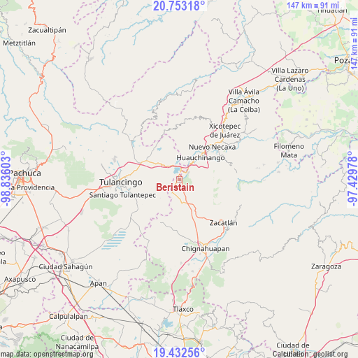
Beristain GPS coordinates[2]
20° 5' 39.336" North, 98° 7' 58.44" West
| Map corner | latitude | longitude |
|---|---|---|
| Upper-left | 20.75318°, | -98.83603° |
| Center: | 20.09426°, | -98.1329° |
| Lower-right: | 19.43256°, | -97.42978° |
| Map W x H: | 146.8×146.8 km | = 91.2×91.2mi |
| max Lat: | 32.7° ⇑41% North |
| Beristain: | 20.09426° |
| min Lat: | ⇓59% South 14.53588° |
| min Long | Beristain | max Long |
| -117.105° | -98.1329° | -86.73105° |
| W 62.1%⇐ | ⇒37.9% E |
Elevation
Elevation of Beristain is 2190 m = 7185 ft, and this is 936.3 m = 3072 ft above average elevation for this country.
| Max E: |
3497 m = 11473 ft | 18% |
| Beristain | 2190 m 7185 ft | |
| Avg. | 1253.7 m = 4113 ft | |
Min E: |
-1 m = -3 ft | 82% |
See also: Mexico elevation on elevation.city.
Geographical zone
Beristain is located in North Torrid zone (between Equator and Tropic of Cancer). Distance of this Northern Tropic circle is 371.6 km =230.9 mi to North.| Distance of | km | miles | from Beristain |
|---|---|---|---|
| North Pole | 7772.8 | 4829.8 | to North |
| Arctic Circle | 5166.9 | 3210.6 | to North |
| Tropic Cancer | 371.6 | 230.9 | to North |
| Equator | 2234.3 | 1388.3 | to South |


Nearby cities:
15 places around Beristain: (largest is in red/bold)
• Ahuazotepec
6.3 km =3.9 mi,  210°
210°
• Camotepec
8.5 km =5.3 mi,  127°
127°
• Coyametepec
7.1 km =4.4 mi,  289°
289°
• El Tejocotal
5.1 km =3.2 mi,  6°
6°
• La Boveda
3.5 km =2.2 mi, 14°
• La Estación de Ahuazotepec
5.3 km =3.3 mi,  201°
201°
• Laguna Seca
6.1 km =3.8 mi,  172°
172°
• Las Puentes
7.8 km =4.8 mi,  224°
224°
• Los Reyes
7.5 km =4.7 mi,  334°
334°
• Mesa de Capulines
2.5 km =1.6 mi,  36°
36°
• Teopancingo
6.6 km =4.1 mi,  90°
90°
• Tepepa
6 km =3.7 mi,  318°
318°
• Tlacomulco
6.7 km =4.2 mi, 11°
• Tlaltegco (Venta Quemada)
8.3 km =5.2 mi,  312°
312°
• Venta Grande
4.4 km =2.7 mi,  51°
51°
Sources, notices
• [Note1] Compared only with cities in Mexico existing in our database
• [Src1] Map data: © OpenStreetMap contributors (CC-BY-SA)
• [Src2] Other city data from geonames.org with taken over terms of usage.
• [Src3] Geographical zone / Annual Mean Temperature by Robert A. Rohde @ Wikipedia
