Tlacpac geodata
Tlacpac (Hidalgo) is a populated place; located in Mexico in America/Mexico_City (GMT-6) time zone. With population of 1,008 people, there are 8648 cities with bigger population in this country. Compared to other cities in Mexico, 60.2% of cities are located further ↓South; 61% of cities are located further ←West and 86.9% of cities have lower elevation than Tlacpac. Note1


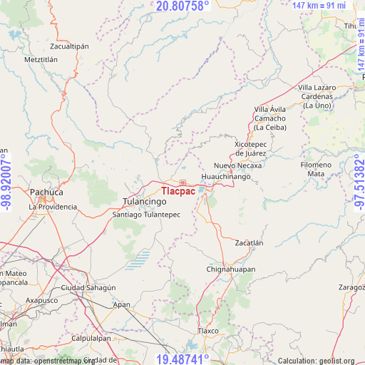
Tlacpac GPS coordinates[2]
20° 8' 56.004" North, 98° 13' 0.984" West
| Map corner | latitude | longitude |
|---|---|---|
| Upper-left | 20.80758°, | -98.92007° |
| Center: | 20.14889°, | -98.21694° |
| Lower-right: | 19.48741°, | -97.51382° |
| Map W x H: | 146.8×146.8 km | = 91.2×91.2mi |
| max Lat: | 32.7° ⇑39.8% North |
| Tlacpac: | 20.14889° |
| min Lat: | ⇓60.2% South 14.53588° |
| min Long | Tlacpac | max Long |
| -117.105° | -98.21694° | -86.73105° |
| W 61%⇐ | ⇒39% E |
Elevation
Elevation of Tlacpac is 2307 m = 7569 ft, and this is 1053.3 m = 3456 ft above average elevation for this country.
| Max E: |
3497 m = 11473 ft | 13.1% |
| Tlacpac | 2307 m 7569 ft | |
| Avg. | 1253.7 m = 4113 ft | |
Min E: |
-1 m = -3 ft | 86.9% |
See also: Mexico elevation on elevation.city.
Geographical zone
Tlacpac is located in North Torrid zone (between Equator and Tropic of Cancer). Distance of this Northern Tropic circle is 365.6 km =227.2 mi to North.| Distance of | km | miles | from Tlacpac |
|---|---|---|---|
| North Pole | 7766.7 | 4826 | to North |
| Arctic Circle | 5160.8 | 3206.8 | to North |
| Tropic Cancer | 365.6 | 227.2 | to North |
| Equator | 2240.3 | 1392.1 | to South |


Nearby cities:
15 places around Tlacpac: (largest is in red/bold)
• Acaxochitlán
1.9 km =1.2 mi,  57°
57°
• Barrio Cuaunepantla
1.5 km =0.9 mi,  307°
307°
• Barrio Techachalco
1.6 km =1 mi,  9°
9°
• Chimalapa
7.4 km =4.6 mi,  53°
53°
• Coyametepec
4.3 km =2.7 mi,  150°
150°
• La Mesa
6.6 km =4.1 mi,  188°
188°
• Los Reyes
5.5 km =3.4 mi,  82°
82°
• San Mateo
4.9 km =3 mi,  320°
320°
• San Pedro Tlachichilco
5.1 km =3.2 mi,  285°
285°
• Santa Ana Tzacuala
5.6 km =3.5 mi, 13°
• Santa María Asunción
5.6 km =3.5 mi,  277°
277°
• Tepaltzingo
6.8 km =4.2 mi,  259°
259°
• Tepepa
5 km =3.1 mi,  108°
108°
• Tlaltegco (Venta Quemada)
2.7 km =1.7 mi,  99°
99°
• Tlatzintla
3 km =1.9 mi,  73°
73°
Sources, notices
• [Note1] Compared only with cities in Mexico existing in our database
• [Src1] Map data: © OpenStreetMap contributors (CC-BY-SA)
• [Src2] Other city data from geonames.org with taken over terms of usage.
• [Src3] Geographical zone / Annual Mean Temperature by Robert A. Rohde @ Wikipedia
