Tepakan geodata
Tepakan (Yucatán) is a populated place; located in Mexico in America/Merida (GMT-6) time zone. With population of 2,064 people, there are 4230 cities with bigger population in this country. Compared to other cities in Mexico, 77.2% of cities are located further ↓South; 98.7% of cities are located further ←West and 95.1% of cities have higher elevation than Tepakan. Note1


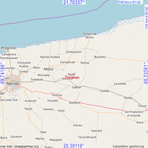
Tepakan GPS coordinates[2]
21° 2' 55.752" North, 89° 2' 19.428" West
| Map corner | latitude | longitude |
|---|---|---|
| Upper-left | 21.70357°, | -89.74186° |
| Center: | 21.04882°, | -89.03873° |
| Lower-right: | 20.39118°, | -88.33561° |
| Map W x H: | 145.9×145.9 km | = 90.7×90.7mi |
| max Lat: | 32.7° ⇑22.8% North |
| Tepakan: | 21.04882° |
| min Lat: | ⇓77.2% South 14.53588° |
| min Long | Tepakan | max Long |
| -117.105° | -89.03873° | -86.73105° |
| W 98.7%⇐ | ⇒1.3% E |
Elevation
Elevation of Tepakan is 13 m = 43 ft, and this is 1240.7 m = 4071 ft below average elevation for this country.
| Max E: |
3497 m = 11473 ft | 95.1% |
| Avg. | 1253.7 m = 4113 ft | |
| Tepakan | 13 m = 43 ft | |
Min E: |
-1 m = -3 ft | 4.9% |
See also: Mexico elevation on elevation.city.
Geographical zone
Tepakan is located in North Torrid zone (between Equator and Tropic of Cancer). Distance of this Northern Tropic circle is 265.5 km =165 mi to North.| Distance of | km | miles | from Tepakan |
|---|---|---|---|
| North Pole | 7666.7 | 4763.9 | to North |
| Arctic Circle | 5060.8 | 3144.6 | to North |
| Tropic Cancer | 265.5 | 165 | to North |
| Equator | 2340.4 | 1454.3 | to South |


Nearby cities:
15 places around Tepakan: (largest is in red/bold)
• Bokoba
15.3 km =9.5 mi,  252°
252°
• Cansahcab
13.7 km =8.5 mi,  331°
331°
• Citilcum
13.6 km =8.5 mi,  217°
217°
• Cuauhtémoc
18.4 km =11.4 mi,  167°
167°
• Dzoncauich
17.9 km =11.1 mi,  59°
59°
• Izamal
12.8 km =8 mi, 170°
• Kimbila
15.6 km =9.7 mi,  214°
214°
• Mesatunych
17.3 km =10.7 mi,  280°
280°
• San Pedro Chacabal
18.7 km =11.6 mi,  300°
300°
• Sitilpech
14.7 km =9.1 mi,  144°
144°
• Suma de Hidalgo
12.1 km =7.5 mi,  290°
290°
• Tekal de Venegas
10.3 km =6.4 mi,  111°
111°
• Tekanto
8.3 km =5.2 mi,  238°
238°
• Temax
15.3 km =9.5 mi,  41°
41°
• Teya
3.6 km =2.2 mi,  273°
273°
Sources, notices
• [Note1] Compared only with cities in Mexico existing in our database
• [Src1] Map data: © OpenStreetMap contributors (CC-BY-SA)
• [Src2] Other city data from geonames.org with taken over terms of usage.
• [Src3] Geographical zone / Annual Mean Temperature by Robert A. Rohde @ Wikipedia
