Tecomatlán geodata
Tecomatlán (Puebla) is a populated place; located in Mexico in America/Mexico_City (GMT-6) time zone. With population of 2,624 people, there are 3376 cities with bigger population in this country. Compared to other cities in Mexico, 77.4% of cities are located further ↑North; 59.7% of cities are located further ←West and 61.3% of cities have higher elevation than Tecomatlán. Note1


Tecomatlán GPS coordinates[2]
18° 6' 34.488" North, 98° 18' 48.312" West
| Map corner | latitude | longitude |
|---|---|---|
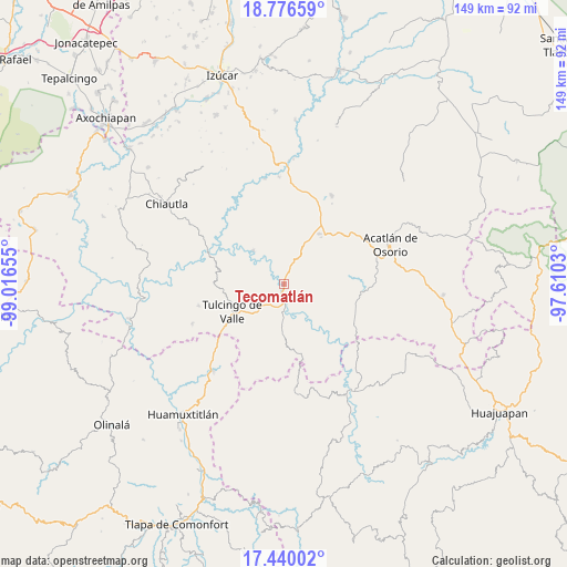
| Upper-left | 18.77659°, | -99.01655° |
| Center: | 18.10958°, | -98.31342° |
| Lower-right: | 17.44002°, | -97.6103° |
| Map W x H: | 148.6×148.6 km | = 92.3×92.3mi |
| max Lat: | 32.7° ⇑77.4% North |
| Tecomatlán: | 18.10958° |
| min Lat: | ⇓22.6% South 14.53588° |
| min Long | Tecomatlán | max Long |
| -117.105° | -98.31342° | -86.73105° |
| W 59.7%⇐ | ⇒40.3% E |
Elevation
Elevation of Tecomatlán is 922 m = 3025 ft, and this is 331.7 m = 1088 ft below average elevation for this country.
| Max E: |
3497 m = 11473 ft | 61.3% |
| Avg. | 1253.7 m = 4113 ft | |
| Tecomatlán | 922 m = 3025 ft | |
Min E: |
-1 m = -3 ft | 38.7% |
See also: Mexico elevation on elevation.city.
Geographical zone
Tecomatlán is located in North Torrid zone (between Equator and Tropic of Cancer). Distance of this Northern Tropic circle is 592.3 km =368 mi to North.| Distance of | km | miles | from Tecomatlán |
|---|---|---|---|
| North Pole | 7993.5 | 4966.9 | to North |
| Arctic Circle | 5387.6 | 3347.7 | to North |
| Tropic Cancer | 592.3 | 368 | to North |
| Equator | 2013.6 | 1251.2 | to South |


Nearby cities:
15 places around Tecomatlán: (largest is in red/bold)
• Ahuehuetitla
15.2 km =9.4 mi,  40°
40°
• Atopoltitlán
17.6 km =10.9 mi,  5°
5°
• Axutla
12 km =7.5 mi,  317°
317°
• Chila de la Sal
18.2 km =11.3 mi,  270°
270°
• Chinantla
11.5 km =7.1 mi,  26°
26°
• Guadalupe Santa Ana
20.5 km =12.7 mi,  95°
95°
• Guadalupe Victoria
16.6 km =10.3 mi,  207°
207°
• Ilamacingo
13.8 km =8.6 mi,  145°
145°
• Mixquitepec
18.4 km =11.4 mi, 100°
• Olomatlán
18.8 km =11.7 mi,  165°
165°
• Piaxtla
11.8 km =7.3 mi, 32°
• Progreso
8 km =5 mi,  178°
178°
• San Antonio Chiltepec
18.4 km =11.4 mi,  128°
128°
• Tulcingo de Valle
15.3 km =9.5 mi,  241°
241°
• Vista Hermosa
19.4 km =12.1 mi, 101°
Sources, notices
• [Note1] Compared only with cities in Mexico existing in our database
• [Src1] Map data: © OpenStreetMap contributors (CC-BY-SA)
• [Src2] Other city data from geonames.org with taken over terms of usage.
• [Src3] Geographical zone / Annual Mean Temperature by Robert A. Rohde @ Wikipedia
