Chila de la Sal geodata
Chila de la Sal (Puebla) is a seat of a second-order administrative division; located in Mexico in America/Mexico_City (GMT-6) time zone. With population of 762 people, there are 11496 cities with bigger population in this country. Compared to other cities in Mexico, 77.4% of cities are located further ↑North; 57.4% of cities are located further ←West and 60.9% of cities have higher elevation than Chila de la Sal. Note1


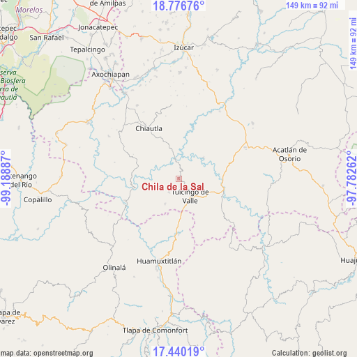
Chila de la Sal GPS coordinates[2]
18° 6' 35.1" North, 98° 29' 8.664" West
| Map corner | latitude | longitude |
|---|---|---|
| Upper-left | 18.77676°, | -99.18887° |
| Center: | 18.10975°, | -98.48574° |
| Lower-right: | 17.44019°, | -97.78262° |
| Map W x H: | 148.6×148.6 km | = 92.3×92.3mi |
| max Lat: | 32.7° ⇑77.4% North |
| Chila de la Sal: | 18.10975° |
| min Lat: | ⇓22.6% South 14.53588° |
| min Long | Chila de la Sal | max Long |
| -117.105° | -98.48574° | -86.73105° |
| W 57.4%⇐ | ⇒42.6% E |
Elevation
Elevation of Chila de la Sal is 945 m = 3100 ft, and this is 308.7 m = 1013 ft below average elevation for this country.
| Max E: |
3497 m = 11473 ft | 60.9% |
| Avg. | 1253.7 m = 4113 ft | |
| Chila de la Sal | 945 m = 3100 ft | |
Min E: |
-1 m = -3 ft | 39.1% |
See also: Mexico elevation on elevation.city.
Geographical zone
Chila de la Sal is located in North Torrid zone (between Equator and Tropic of Cancer). Distance of this Northern Tropic circle is 592.3 km =368 mi to North.| Distance of | km | miles | from Chila de la Sal |
|---|---|---|---|
| North Pole | 7993.4 | 4966.9 | to North |
| Arctic Circle | 5387.6 | 3347.7 | to North |
| Tropic Cancer | 592.3 | 368 | to North |
| Equator | 2013.6 | 1251.2 | to South |


Nearby cities:
15 places around Chila de la Sal: (largest is in red/bold)
• Acaxtlahuacán de Albino Zertuche
11.8 km =7.3 mi,  209°
209°
• Axutla
13.5 km =8.4 mi,  48°
48°
• Chiautla de Tapia
24.7 km =15.3 mi,  329°
329°
• Ciudad de Chiautla de Tapia
24.6 km =15.3 mi, 329°
• Coacalco
19.7 km =12.2 mi,  257°
257°
• Guadalupe Victoria
18.1 km =11.2 mi,  144°
144°
• Ixcamilpa
24.1 km =15 mi,  247°
247°
• Progreso
20.1 km =12.5 mi,  113°
113°
• San Miguel Comitlipa
17.5 km =10.9 mi,  203°
203°
• San Miguel Tlaltepexi
22.6 km =14 mi,  162°
162°
• Tecomatlán
18.2 km =11.3 mi,  90°
90°
• Toltecamila
21.6 km =13.4 mi,  220°
220°
• Tulcingo de Valle
8.7 km =5.4 mi,  147°
147°
• Xicotlán
7 km =4.3 mi, 216°
• Xochihuehuetlán
22.6 km =14 mi,  180°
180°
Sources, notices
• [Note1] Compared only with cities in Mexico existing in our database
• [Src1] Map data: © OpenStreetMap contributors (CC-BY-SA)
• [Src2] Other city data from geonames.org with taken over terms of usage.
• [Src3] Geographical zone / Annual Mean Temperature by Robert A. Rohde @ Wikipedia
