Tapalapa geodata
Tapalapa (Chiapas) is a seat of a second-order administrative division; located in Mexico in America/Mexico_City (GMT-6) time zone. With population of 1,940 people, there are 4485 cities with bigger population in this country. Compared to other cities in Mexico, 86.7% of cities are located further ↑North; 88.1% of cities are located further ←West and 59.5% of cities have lower elevation than Tapalapa. Note1


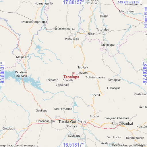
Tapalapa GPS coordinates[2]
17° 11' 27.924" North, 93° 6' 18.648" West
| Map corner | latitude | longitude |
|---|---|---|
| Upper-left | 17.86157°, | -93.80831° |
| Center: | 17.19109°, | -93.10518° |
| Lower-right: | 16.51817°, | -92.40206° |
| Map W x H: | 149.4×149.4 km | = 92.8×92.8mi |
| max Lat: | 32.7° ⇑86.7% North |
| Tapalapa: | 17.19109° |
| min Lat: | ⇓13.3% South 14.53588° |
| min Long | Tapalapa | max Long |
| -117.105° | -93.10518° | -86.73105° |
| W 88.1%⇐ | ⇒11.9% E |
Elevation
Elevation of Tapalapa is 1718 m = 5636 ft, and this is 464.3 m = 1523 ft above average elevation for this country.
| Max E: |
3497 m = 11473 ft | 40.5% |
| Tapalapa | 1718 m 5636 ft | |
| Avg. | 1253.7 m = 4113 ft | |
Min E: |
-1 m = -3 ft | 59.5% |
See also: Mexico elevation on elevation.city.
Geographical zone
Tapalapa is located in North Torrid zone (between Equator and Tropic of Cancer). Distance of this Northern Tropic circle is 694.4 km =431.5 mi to North.| Distance of | km | miles | from Tapalapa |
|---|---|---|---|
| North Pole | 8095.6 | 5030.4 | to North |
| Arctic Circle | 5489.7 | 3411.1 | to North |
| Tropic Cancer | 694.4 | 431.5 | to North |
| Equator | 1911.5 | 1187.8 | to South |


Nearby cities:
15 places around Tapalapa: (largest is in red/bold)
• Buenavista (Matasanos)
10.1 km =6.3 mi,  156°
156°
• Coapilla
8.8 km =5.5 mi,  220°
220°
• El Carrizal
4.4 km =2.7 mi,  137°
137°
• El Triunfo
6.2 km =3.9 mi,  62°
62°
• Llano Grande
10 km =6.2 mi,  192°
192°
• Ocotepec
7.4 km =4.6 mi,  301°
301°
• Pantepec
5.9 km =3.7 mi,  92°
92°
• Rayón
10.1 km =6.3 mi,  83°
83°
• San Andrés Carrizal
4.9 km =3 mi, 304°
• San Antonio Poyono
10.6 km =6.6 mi,  284°
284°
• San Francisco Jaconá
11.1 km =6.9 mi,  44°
44°
• San Francisco Ocotal
5.5 km =3.4 mi, 300°
• San Isidro las Banderas
6.5 km =4 mi,  47°
47°
• San Pablo Huacano
10.9 km =6.8 mi,  272°
272°
• Vicente Guerrero
8.1 km =5 mi, 143°
Sources, notices
• [Note1] Compared only with cities in Mexico existing in our database
• [Src1] Map data: © OpenStreetMap contributors (CC-BY-SA)
• [Src2] Other city data from geonames.org with taken over terms of usage.
• [Src3] Geographical zone / Annual Mean Temperature by Robert A. Rohde @ Wikipedia
