Pantepec geodata
Pantepec (Chiapas) is a seat of a second-order administrative division; located in Mexico in America/Mexico_City (GMT-6) time zone. With population of 1,820 people, there are 4784 cities with bigger population in this country. Compared to other cities in Mexico, 86.7% of cities are located further ↑North; 88.3% of cities are located further ←West and 50.8% of cities have lower elevation than Pantepec. Note1


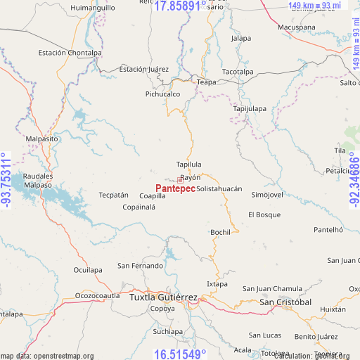
Pantepec GPS coordinates[2]
17° 11' 18.312" North, 93° 2' 59.928" West
| Map corner | latitude | longitude |
|---|---|---|
| Upper-left | 17.85891°, | -93.75311° |
| Center: | 17.18842°, | -93.04998° |
| Lower-right: | 16.51549°, | -92.34686° |
| Map W x H: | 149.4×149.4 km | = 92.8×92.8mi |
| max Lat: | 32.7° ⇑86.7% North |
| Pantepec: | 17.18842° |
| min Lat: | ⇓13.3% South 14.53588° |
| min Long | Pantepec | max Long |
| -117.105° | -93.04998° | -86.73105° |
| W 88.3%⇐ | ⇒11.7% E |
Elevation
Elevation of Pantepec is 1477 m = 4846 ft, and this is 223.3 m = 733 ft above average elevation for this country.
| Max E: |
3497 m = 11473 ft | 49.2% |
| Pantepec | 1477 m 4846 ft | |
| Avg. | 1253.7 m = 4113 ft | |
Min E: |
-1 m = -3 ft | 50.8% |
See also: Mexico elevation on elevation.city.
Geographical zone
Pantepec is located in North Torrid zone (between Equator and Tropic of Cancer). Distance of this Northern Tropic circle is 694.7 km =431.7 mi to North.| Distance of | km | miles | from Pantepec |
|---|---|---|---|
| North Pole | 8095.9 | 5030.6 | to North |
| Arctic Circle | 5490 | 3411.3 | to North |
| Tropic Cancer | 694.7 | 431.7 | to North |
| Equator | 1911.2 | 1187.6 | to South |


Nearby cities:
15 places around Pantepec: (largest is in red/bold)
• Buenavista (Matasanos)
9.1 km =5.7 mi,  191°
191°
• El Amate
8.6 km =5.3 mi,  146°
146°
• El Carrizal
4.1 km =2.5 mi,  224°
224°
• El Pinabeto
9.9 km =6.2 mi,  77°
77°
• El Triunfo
3.2 km =2 mi,  353°
353°
• Julián Grajales
10 km =6.2 mi,  130°
130°
• Rayón
4.4 km =2.7 mi,  70°
70°
• Rincón Chamula
12 km =7.5 mi, 79°
• San Andrés Carrizal
10.3 km =6.4 mi,  287°
287°
• San Francisco Jaconá
8.5 km =5.3 mi,  12°
12°
• San Francisco Ocotal
11.1 km =6.9 mi, 286°
• San Isidro las Banderas
4.8 km =3 mi, 346°
• Tapalapa
5.9 km =3.7 mi,  272°
272°
• Tapilula
7.7 km =4.8 mi,  27°
27°
• Vicente Guerrero
6.3 km =3.9 mi, 189°
Sources, notices
• [Note1] Compared only with cities in Mexico existing in our database
• [Src1] Map data: © OpenStreetMap contributors (CC-BY-SA)
• [Src2] Other city data from geonames.org with taken over terms of usage.
• [Src3] Geographical zone / Annual Mean Temperature by Robert A. Rohde @ Wikipedia
