San Francisco Ocotal geodata
San Francisco Ocotal (Chiapas) is a populated place; located in Mexico in America/Mexico_City (GMT-6) time zone. With population of 601 people, there are 14318 cities with bigger population in this country. Compared to other cities in Mexico, 86.4% of cities are located further ↑North; 87.8% of cities are located further ←West and 51.3% of cities have lower elevation than San Francisco Ocotal. Note1
Current local time in San Francisco Ocotal:
05:23 AM, WednesdayDifference from your time zone: hours


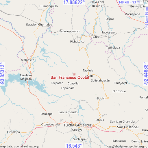
San Francisco Ocotal GPS coordinates[2]
17° 12' 56.988" North, 93° 9' 0" West
| Map corner | latitude | longitude |
|---|---|---|
| Upper-left | 17.88622°, | -93.85313° |
| Center: | 17.21583°, | -93.15° |
| Lower-right: | 16.543°, | -92.44688° |
| Map W x H: | 149.4×149.4 km | = 92.8×92.8mi |
| max Lat: | 32.7° ⇑86.4% North |
| San Francisco Ocotal: | 17.21583° |
| min Lat: | ⇓13.6% South 14.53588° |
| min Long | San Francisco O | max Long |
| -117.105° | -93.15° | -86.73105° |
| W 87.8%⇐ | ⇒12.2% E |
Elevation
Elevation of San Francisco Ocotal is 1498 m = 4915 ft, and this is 244.3 m = 802 ft above average elevation for this country.
| Max E: |
3497 m = 11473 ft | 48.7% |
| San Francisco Ocotal | 1498 m 4915 ft | |
| Avg. | 1253.7 m = 4113 ft | |
Min E: |
-1 m = -3 ft | 51.3% |
See also: Mexico elevation on elevation.city.
Geographical zone
San Francisco Ocotal is located in North Torrid zone (between Equator and Tropic of Cancer). Distance of this Northern Tropic circle is 691.7 km =429.8 mi to North.| Distance of | km | miles | from San Francisco Ocotal |
|---|---|---|---|
| North Pole | 8092.8 | 5028.6 | to North |
| Arctic Circle | 5487 | 3409.5 | to North |
| Tropic Cancer | 691.7 | 429.8 | to North |
| Equator | 1914.2 | 1189.4 | to South |


Nearby cities:
15 places around San Francisco Ocotal: (largest is in red/bold)
• Coapilla
9.4 km =5.8 mi,  186°
186°
• El Carrizal
9.8 km =6.1 mi,  127°
127°
• El Triunfo
10.2 km =6.3 mi,  89°
89°
• Guadalupe Victoria
11.9 km =7.4 mi,  354°
354°
• Llano Grande
12.8 km =8 mi,  168°
168°
• Miguel Hidalgo (Zacalapa)
11.3 km =7 mi,  214°
214°
• Naranjo
11 km =6.8 mi,  316°
316°
• Ocotepec
1.9 km =1.2 mi,  307°
307°
• Pantepec
11.1 km =6.9 mi,  106°
106°
• San Andrés Carrizal
0.7 km =0.4 mi, 90°
• San Antonio Poyono
5.5 km =3.4 mi,  269°
269°
• San Isidro las Banderas
9.7 km =6 mi,  80°
80°
• San Pablo Huacano
6.5 km =4 mi,  249°
249°
• Tapalapa
5.5 km =3.4 mi,  120°
120°
• Vicente Guerrero
10.4 km =6.5 mi, 323°
Sources, notices
• [Note1] Compared only with cities in Mexico existing in our database
• [Src1] Map data: © OpenStreetMap contributors (CC-BY-SA)
• [Src2] Other city data from geonames.org with taken over terms of usage.
• [Src3] Geographical zone / Annual Mean Temperature by Robert A. Rohde @ Wikipedia
