Congregación el Tajín geodata
Congregación el Tajín (Veracruz) is a populated place; located in Mexico in America/Mexico_City (GMT-6) time zone. With population of 1,363 people, there are 6372 cities with bigger population in this country. Compared to other cities in Mexico, 66.3% of cities are located further ↓South; 70.7% of cities are located further ←West and 79.3% of cities have higher elevation than Congregación el Tajín. Note1
Current local time in Congregación el Tajín:
12:46 AM, WednesdayDifference from your time zone: hours


Congregación el Tajín GPS coordinates[2]
20° 25' 49.692" North, 97° 22' 54.588" West
| Map corner | latitude | longitude |
|---|---|---|
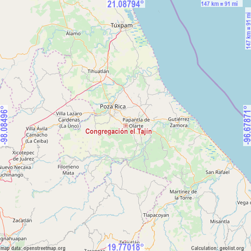
| Upper-left | 21.08794°, | -98.08496° |
| Center: | 20.43047°, | -97.38183° |
| Lower-right: | 19.77018°, | -96.67871° |
| Map W x H: | 146.5×146.5 km | = 91×91mi |
| max Lat: | 32.7° ⇑33.7% North |
| Congregación el Tajín: | 20.43047° |
| min Lat: | ⇓66.3% South 14.53588° |
| min Long | Congregación e | max Long |
| -117.105° | -97.38183° | -86.73105° |
| W 70.7%⇐ | ⇒29.3% E |
Elevation
Elevation of Congregación el Tajín is 105 m = 344 ft, and this is 1148.7 m = 3769 ft below average elevation for this country.
| Max E: |
3497 m = 11473 ft | 79.3% |
| Avg. | 1253.7 m = 4113 ft | |
| Congregación el Tajín | 105 m = 344 ft | |
Min E: |
-1 m = -3 ft | 20.7% |
See also: Mexico elevation on elevation.city.
Geographical zone
Congregación el Tajín is located in North Torrid zone (between Equator and Tropic of Cancer). Distance of this Northern Tropic circle is 334.3 km =207.7 mi to North.| Distance of | km | miles | from Congregación el Tajín |
|---|---|---|---|
| North Pole | 7735.4 | 4806.6 | to North |
| Arctic Circle | 5129.5 | 3187.3 | to North |
| Tropic Cancer | 334.3 | 207.7 | to North |
| Equator | 2271.7 | 1411.6 | to South |


Nearby cities:
15 places around Congregación el Tajín: (largest is in red/bold)
• Arroyo del Arco
9.1 km =5.7 mi,  150°
150°
• El Chote
5.1 km =3.2 mi,  129°
129°
• El Porvenir Número Uno
9.8 km =6.1 mi,  117°
117°
• Escolín de Olarte
8.7 km =5.4 mi,  330°
330°
• Francisco Villa
9 km =5.6 mi,  144°
144°
• Gildardo Muñoz
4 km =2.5 mi,  194°
194°
• La Grandeza
9.7 km =6 mi,  358°
358°
• La Laguna
6.5 km =4 mi,  281°
281°
• Papantla de Olarte
6.2 km =3.9 mi,  73°
73°
• Plan de Hidalgo
7 km =4.3 mi,  241°
241°
• Plan del Palmar
8.1 km =5 mi,  251°
251°
• Reforma Escolín
6.3 km =3.9 mi, 355°
• Serafín Olarte
8.1 km =5 mi, 141°
• Tlahuanapa
2.8 km =1.7 mi, 136°
• Vista Hermosa de Madero
8.3 km =5.2 mi,  218°
218°
Sources, notices
• [Note1] Compared only with cities in Mexico existing in our database
• [Src1] Map data: © OpenStreetMap contributors (CC-BY-SA)
• [Src2] Other city data from geonames.org with taken over terms of usage.
• [Src3] Geographical zone / Annual Mean Temperature by Robert A. Rohde @ Wikipedia
