Santiago Nuyoó geodata
Santiago Nuyoó (Oaxaca) is a seat of a second-order administrative division; located in Mexico in America/Mexico_City (GMT-6) time zone. With population of 403 people, there are 16844 cities with bigger population in this country. Compared to other cities in Mexico, 88.7% of cities are located further ↑North; 66.5% of cities are located further ←West and 56.7% of cities have lower elevation than Santiago Nuyoó. Note1


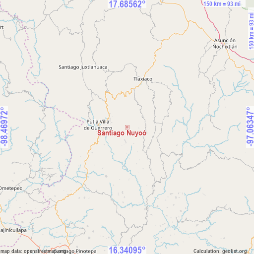
Santiago Nuyoó GPS coordinates[2]
17° 0' 52.164" North, 97° 45' 59.724" West
| Map corner | latitude | longitude |
|---|---|---|
| Upper-left | 17.68562°, | -98.46972° |
| Center: | 17.01449°, | -97.76659° |
| Lower-right: | 16.34095°, | -97.06347° |
| Map W x H: | 149.5×149.5 km | = 92.9×92.9mi |
| max Lat: | 32.7° ⇑88.7% North |
| Santiago Nuyoó: | 17.01449° |
| min Lat: | ⇓11.3% South 14.53588° |
| min Long | Santiago Nuyoó | max Long |
| -117.105° | -97.76659° | -86.73105° |
| W 66.5%⇐ | ⇒33.5% E |
Elevation
Elevation of Santiago Nuyoó is 1649 m = 5410 ft, and this is 395.3 m = 1297 ft above average elevation for this country.
| Max E: |
3497 m = 11473 ft | 43.3% |
| Santiago Nuyoó | 1649 m 5410 ft | |
| Avg. | 1253.7 m = 4113 ft | |
Min E: |
-1 m = -3 ft | 56.7% |
See also: Mexico elevation on elevation.city.
Geographical zone
Santiago Nuyoó is located in North Torrid zone (between Equator and Tropic of Cancer). Distance of this Northern Tropic circle is 714.1 km =443.7 mi to North.| Distance of | km | miles | from Santiago Nuyoó |
|---|---|---|---|
| North Pole | 8115.2 | 5042.5 | to North |
| Arctic Circle | 5509.3 | 3423.3 | to North |
| Tropic Cancer | 714.1 | 443.7 | to North |
| Equator | 1891.8 | 1175.5 | to South |


Nearby cities:
15 places around Santiago Nuyoó: (largest is in red/bold)
• Agua del Toro
5.9 km =3.7 mi,  114°
114°
• Concepción del Progreso
10.8 km =6.7 mi,  289°
289°
• Diecinueve de Abril
13.4 km =8.3 mi,  353°
353°
• La Zafra
13.3 km =8.3 mi,  255°
255°
• Malpica
15.2 km =9.4 mi,  268°
268°
• Miramar
3.7 km =2.3 mi,  246°
246°
• Ojo de Agua
14.7 km =9.1 mi,  24°
24°
• San Esteban Atatlahuca
11.1 km =6.9 mi,  58°
58°
• San Juan Teponaxtla
9.8 km =6.1 mi,  281°
281°
• San Pedro Siniyuvi
8.6 km =5.3 mi, 247°
• San Sebastián Nopalera
8 km =5 mi,  188°
188°
• Santa María Ocotlán
6.9 km =4.3 mi,  145°
145°
• Santa María Yucuhiti
0.6 km =0.4 mi,  326°
326°
• Yutecoso Cuauhtémoc
12.4 km =7.7 mi, 145°
• Zimatlán
10.9 km =6.8 mi,  219°
219°
Sources, notices
• [Note1] Compared only with cities in Mexico existing in our database
• [Src1] Map data: © OpenStreetMap contributors (CC-BY-SA)
• [Src2] Other city data from geonames.org with taken over terms of usage.
• [Src3] Geographical zone / Annual Mean Temperature by Robert A. Rohde @ Wikipedia
