San Juan Teponaxtla geodata
San Juan Teponaxtla (Oaxaca) is a populated place; located in Mexico in America/Mexico_City (GMT-6) time zone. With population of 791 people, there are 11037 cities with bigger population in this country. Compared to other cities in Mexico, 88.5% of cities are located further ↑North; 65.3% of cities are located further ←West and 62.9% of cities have higher elevation than San Juan Teponaxtla. Note1


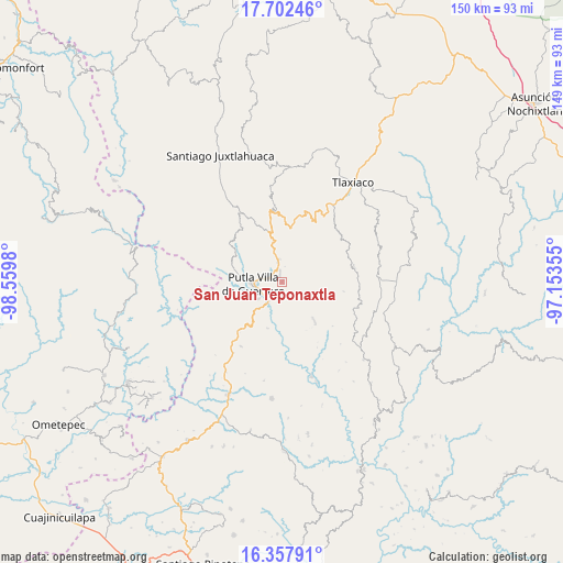
San Juan Teponaxtla GPS coordinates[2]
17° 1' 53.004" North, 97° 51' 24.012" West
| Map corner | latitude | longitude |
|---|---|---|
| Upper-left | 17.70246°, | -98.5598° |
| Center: | 17.03139°, | -97.85667° |
| Lower-right: | 16.35791°, | -97.15355° |
| Map W x H: | 149.5×149.5 km | = 92.9×92.9mi |
| max Lat: | 32.7° ⇑88.5% North |
| San Juan Teponaxtla: | 17.03139° |
| min Lat: | ⇓11.5% South 14.53588° |
| min Long | San Juan Tepona | max Long |
| -117.105° | -97.85667° | -86.73105° |
| W 65.3%⇐ | ⇒34.7% E |
Elevation
Elevation of San Juan Teponaxtla is 827 m = 2713 ft, and this is 426.7 m = 1400 ft below average elevation for this country.
| Max E: |
3497 m = 11473 ft | 62.9% |
| Avg. | 1253.7 m = 4113 ft | |
| San Juan Teponaxtla | 827 m = 2713 ft | |
Min E: |
-1 m = -3 ft | 37.1% |
See also: Mexico elevation on elevation.city.
Geographical zone
San Juan Teponaxtla is located in North Torrid zone (between Equator and Tropic of Cancer). Distance of this Northern Tropic circle is 712.2 km =442.5 mi to North.| Distance of | km | miles | from San Juan Teponaxtla |
|---|---|---|---|
| North Pole | 8113.3 | 5041.4 | to North |
| Arctic Circle | 5507.5 | 3422.2 | to North |
| Tropic Cancer | 712.2 | 442.5 | to North |
| Equator | 1893.7 | 1176.7 | to South |


Nearby cities:
15 places around San Juan Teponaxtla: (largest is in red/bold)
• Concepción del Progreso
1.8 km =1.1 mi,  341°
341°
• Constancia del Rosario
9 km =5.6 mi,  274°
274°
• La Zafra
6.2 km =3.9 mi,  213°
213°
• Malpica
6 km =3.7 mi,  248°
248°
• Miramar
7 km =4.3 mi,  118°
118°
• Putla Villa de Guerrero
7.7 km =4.8 mi, 265°
• San Juan Lagunas
8.7 km =5.4 mi,  244°
244°
• San Miguel Copala
8.4 km =5.2 mi,  293°
293°
• San Miguel Reyes
12.8 km =8 mi,  197°
197°
• San Pedro Siniyuvi
5.5 km =3.4 mi,  162°
162°
• San Sebastián Nopalera
12.9 km =8 mi,  139°
139°
• Santa María Yucuhiti
9.4 km =5.8 mi,  98°
98°
• Santiago Nuyoó
9.8 km =6.1 mi, 101°
• Santo Domingo del Estado
13.9 km =8.6 mi,  3°
3°
• Zimatlán
10.7 km =6.6 mi,  165°
165°
Sources, notices
• [Note1] Compared only with cities in Mexico existing in our database
• [Src1] Map data: © OpenStreetMap contributors (CC-BY-SA)
• [Src2] Other city data from geonames.org with taken over terms of usage.
• [Src3] Geographical zone / Annual Mean Temperature by Robert A. Rohde @ Wikipedia
