San Miguel Huautla geodata
San Miguel Huautla (Oaxaca) is a seat of a second-order administrative division; located in Mexico in America/Mexico_City (GMT-6) time zone. In our database, there are 16903 cities with bigger population. Compared to other cities in Mexico, 81% of cities are located further ↑North; 73.1% of cities are located further ←West and 70.4% of cities have lower elevation than San Miguel Huautla. Note1


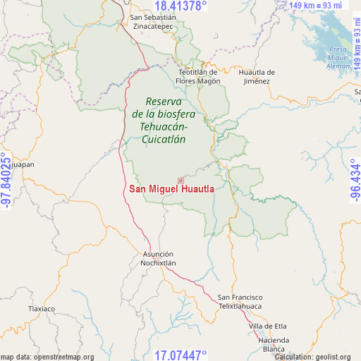
San Miguel Huautla GPS coordinates[2]
17° 44' 43.368" North, 97° 8' 13.632" West
| Map corner | latitude | longitude |
|---|---|---|
| Upper-left | 18.41378°, | -97.84025° |
| Center: | 17.74538°, | -97.13712° |
| Lower-right: | 17.07447°, | -96.434° |
| Map W x H: | 148.9×148.9 km | = 92.5×92.5mi |
| max Lat: | 32.7° ⇑81% North |
| San Miguel Huautla: | 17.74538° |
| min Lat: | ⇓19% South 14.53588° |
| min Long | San Miguel Huau | max Long |
| -117.105° | -97.13712° | -86.73105° |
| W 73.1%⇐ | ⇒26.9% E |
Elevation
Elevation of San Miguel Huautla is 1932 m = 6339 ft, and this is 678.3 m = 2225 ft above average elevation for this country.
| Max E: |
3497 m = 11473 ft | 29.6% |
| San Miguel Huautla | 1932 m 6339 ft | |
| Avg. | 1253.7 m = 4113 ft | |
Min E: |
-1 m = -3 ft | 70.4% |
See also: Mexico elevation on elevation.city.
Geographical zone
San Miguel Huautla is located in North Torrid zone (between Equator and Tropic of Cancer). Distance of this Northern Tropic circle is 632.8 km =393.2 mi to North.| Distance of | km | miles | from San Miguel Huautla |
|---|---|---|---|
| North Pole | 8034 | 4992.1 | to North |
| Arctic Circle | 5428.1 | 3372.9 | to North |
| Tropic Cancer | 632.8 | 393.2 | to North |
| Equator | 1973.1 | 1226 | to South |


Nearby cities:
15 places around San Miguel Huautla: (largest is in red/bold)
• Apoala
10.8 km =6.7 mi,  179°
179°
• Chicahua
13.6 km =8.5 mi,  206°
206°
• Coixtlahuaca
19.4 km =12.1 mi,  261°
261°
• Cuicatlan
19.9 km =12.4 mi,  71°
71°
• El Fortín Alto
16.4 km =10.2 mi,  202°
202°
• Ixcatlán
13.4 km =8.3 mi,  333°
333°
• Jaltepetongo
12.6 km =7.8 mi,  121°
121°
• San José del Chilar
21.5 km =13.4 mi,  100°
100°
• San Miguel Huautla
0.8 km =0.5 mi,  227°
227°
• San Pedro Chicozapotes
19.1 km =11.9 mi,  82°
82°
• San Pedro Jocotipac
6.7 km =4.2 mi, 67°
• Santa María Apazco
12.9 km =8 mi,  162°
162°
• Texcatitlán
8.3 km =5.2 mi, 115°
• Tomellín
18.7 km =11.6 mi,  85°
85°
• Valerio Trujano
16.9 km =10.5 mi, 79°
Sources, notices
• [Note1] Compared only with cities in Mexico existing in our database
• [Src1] Map data: © OpenStreetMap contributors (CC-BY-SA)
• [Src2] Other city data from geonames.org with taken over terms of usage.
• [Src3] Geographical zone / Annual Mean Temperature by Robert A. Rohde @ Wikipedia
