San Miguel Tecuiciapan geodata
San Miguel Tecuiciapan (Guerrero) is a populated place; located in Mexico in America/Mexico_City (GMT-6) time zone. With population of 1,574 people, there are 5488 cities with bigger population in this country. Compared to other cities in Mexico, 79.1% of cities are located further ↑North; 55.8% of cities are located further →East and 68% of cities have higher elevation than San Miguel Tecuiciapan. Note1


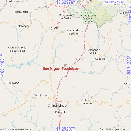
San Miguel Tecuiciapan GPS coordinates[2]
17° 57' 43.848" North, 99° 24' 54.648" West
| Map corner | latitude | longitude |
|---|---|---|
| Upper-left | 18.62976°, | -100.11831° |
| Center: | 17.96218°, | -99.41518° |
| Lower-right: | 17.29207°, | -98.71206° |
| Map W x H: | 148.7×148.7 km | = 92.4×92.4mi |
| max Lat: | 32.7° ⇑79.1% North |
| San Miguel Tecuiciapan: | 17.96218° |
| min Lat: | ⇓20.9% South 14.53588° |
| min Long | San Miguel Tecu | max Long |
| -117.105° | -99.41518° | -86.73105° |
| W 44.2%⇐ | ⇒55.8% E |
Elevation
Elevation of San Miguel Tecuiciapan is 529 m = 1736 ft, and this is 724.7 m = 2378 ft below average elevation for this country.
| Max E: |
3497 m = 11473 ft | 68% |
| Avg. | 1253.7 m = 4113 ft | |
| San Miguel Tecuiciapan | 529 m = 1736 ft | |
Min E: |
-1 m = -3 ft | 32% |
See also: Mexico elevation on elevation.city.
Geographical zone
San Miguel Tecuiciapan is located in North Torrid zone (between Equator and Tropic of Cancer). Distance of this Northern Tropic circle is 608.7 km =378.2 mi to North.| Distance of | km | miles | from San Miguel Tecuiciapan |
|---|---|---|---|
| North Pole | 8009.9 | 4977.1 | to North |
| Arctic Circle | 5404 | 3357.9 | to North |
| Tropic Cancer | 608.7 | 378.2 | to North |
| Equator | 1997.2 | 1241 | to South |


Nearby cities:
15 places around San Miguel Tecuiciapan: (largest is in red/bold)
• Ahuehuepan
10.2 km =6.3 mi,  298°
298°
• Ahuelicán
9.4 km =5.8 mi,  317°
317°
• Ameyaltepec
9.9 km =6.2 mi,  272°
272°
• Axaxacualco
18.3 km =11.4 mi,  195°
195°
• San Agustín Oapan
2.6 km =1.6 mi,  246°
246°
• San Agustín Ostotipan
8.4 km =5.2 mi,  123°
123°
• San Francisco Ozomatlán
9 km =5.6 mi, 116°
• San Juan Tetelcingo
11.8 km =7.3 mi, 247°
• San Juan Totolcintla
11.2 km =7 mi, 123°
• San Marcos Oacatzingo
7.7 km =4.8 mi, 246°
• Tlamamacan
12.6 km =7.8 mi, 249°
• Tlanipatla
17.6 km =10.9 mi,  192°
192°
• Tula del Río
7.1 km =4.4 mi,  126°
126°
• Tulimán
18.4 km =11.4 mi,  66°
66°
• Xalitla
14.2 km =8.8 mi,  286°
286°
Sources, notices
• [Note1] Compared only with cities in Mexico existing in our database
• [Src1] Map data: © OpenStreetMap contributors (CC-BY-SA)
• [Src2] Other city data from geonames.org with taken over terms of usage.
• [Src3] Geographical zone / Annual Mean Temperature by Robert A. Rohde @ Wikipedia
