San Francisco Ozomatlán geodata
San Francisco Ozomatlán (Guerrero) is a populated place; located in Mexico in America/Mexico_City (GMT-6) time zone. With population of 1,410 people, there are 6134 cities with bigger population in this country. Compared to other cities in Mexico, 79.4% of cities are located further ↑North; 54.7% of cities are located further →East and 67.9% of cities have higher elevation than San Francisco Ozomatlán. Note1
Current local time in San Francisco Ozomatlán:
12:34 PM, MondayDifference from your time zone: hours


San Francisco Ozomatlán GPS coordinates[2]
17° 55' 31.332" North, 99° 20' 20.472" West
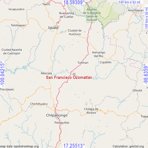
| Map corner | latitude | longitude |
|---|---|---|
| Upper-left | 18.59309°, | -100.04215° |
| Center: | 17.92537°, | -99.33902° |
| Lower-right: | 17.25513°, | -98.6359° |
| Map W x H: | 148.8×148.8 km | = 92.5×92.5mi |
| max Lat: | 32.7° ⇑79.4% North |
| San Francisco Ozomatlán: | 17.92537° |
| min Lat: | ⇓20.6% South 14.53588° |
| min Long | San Francisco O | max Long |
| -117.105° | -99.33902° | -86.73105° |
| W 45.3%⇐ | ⇒54.7% E |
Elevation
Elevation of San Francisco Ozomatlán is 534 m = 1752 ft, and this is 719.7 m = 2361 ft below average elevation for this country.
| Max E: |
3497 m = 11473 ft | 67.9% |
| Avg. | 1253.7 m = 4113 ft | |
| San Francisco Ozomatlán | 534 m = 1752 ft | |
Min E: |
-1 m = -3 ft | 32.1% |
See also: Mexico elevation on elevation.city.
Geographical zone
San Francisco Ozomatlán is located in North Torrid zone (between Equator and Tropic of Cancer). Distance of this Northern Tropic circle is 612.8 km =380.8 mi to North.| Distance of | km | miles | from San Francisco Ozomatlán |
|---|---|---|---|
| North Pole | 8013.9 | 4979.6 | to North |
| Arctic Circle | 5408.1 | 3360.4 | to North |
| Tropic Cancer | 612.8 | 380.8 | to North |
| Equator | 1993.1 | 1238.5 | to South |


Nearby cities:
15 places around San Francisco Ozomatlán: (largest is in red/bold)
• Ahuehuepan
19.3 km =12 mi,  297°
297°
• Ahuelicán
18.1 km =11.2 mi,  307°
307°
• Ameyaltepec
18.5 km =11.5 mi,  284°
284°
• Apango
20.5 km =12.7 mi,  177°
177°
• Axaxacualco
18.7 km =11.6 mi,  223°
223°
• San Agustín Oapan
10.9 km =6.8 mi,  286°
286°
• San Agustín Ostotipan
1.2 km =0.7 mi,  242°
242°
• San Juan Tetelcingo
19 km =11.8 mi,  268°
268°
• San Juan Totolcintla
2.4 km =1.5 mi,  148°
148°
• San Marcos Oacatzingo
15.1 km =9.4 mi, 273°
• San Miguel Tecuiciapan
9 km =5.6 mi, 296°
• Tlamamacan
19.8 km =12.3 mi, 269°
• Tlanipatla
17.7 km =11 mi, 222°
• Tula del Río
2.4 km =1.5 mi, 268°
• Tulimán
14.5 km =9 mi,  37°
37°
Sources, notices
• [Note1] Compared only with cities in Mexico existing in our database
• [Src1] Map data: © OpenStreetMap contributors (CC-BY-SA)
• [Src2] Other city data from geonames.org with taken over terms of usage.
• [Src3] Geographical zone / Annual Mean Temperature by Robert A. Rohde @ Wikipedia
