San Agustín Oapan geodata
San Agustín Oapan (Guerrero) is a populated place; located in Mexico in America/Mexico_City (GMT-6) time zone. With population of 1,912 people, there are 4548 cities with bigger population in this country. Compared to other cities in Mexico, 79.2% of cities are located further ↑North; 56.1% of cities are located further →East and 68.2% of cities have higher elevation than San Agustín Oapan. Note1


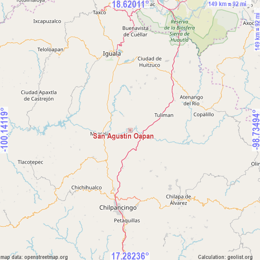
San Agustín Oapan GPS coordinates[2]
17° 57' 9" North, 99° 26' 17.016" West
| Map corner | latitude | longitude |
|---|---|---|
| Upper-left | 18.62011°, | -100.14119° |
| Center: | 17.9525°, | -99.43806° |
| Lower-right: | 17.28236°, | -98.73494° |
| Map W x H: | 148.7×148.7 km | = 92.4×92.4mi |
| max Lat: | 32.7° ⇑79.2% North |
| San Agustín Oapan: | 17.9525° |
| min Lat: | ⇓20.8% South 14.53588° |
| min Long | San Agustín Oa | max Long |
| -117.105° | -99.43806° | -86.73105° |
| W 43.9%⇐ | ⇒56.1% E |
Elevation
Elevation of San Agustín Oapan is 514 m = 1686 ft, and this is 739.7 m = 2427 ft below average elevation for this country.
| Max E: |
3497 m = 11473 ft | 68.2% |
| Avg. | 1253.7 m = 4113 ft | |
| San Agustín Oapan | 514 m = 1686 ft | |
Min E: |
-1 m = -3 ft | 31.8% |
See also: Mexico elevation on elevation.city.
Geographical zone
San Agustín Oapan is located in North Torrid zone (between Equator and Tropic of Cancer). Distance of this Northern Tropic circle is 609.8 km =378.9 mi to North.| Distance of | km | miles | from San Agustín Oapan |
|---|---|---|---|
| North Pole | 8010.9 | 4977.7 | to North |
| Arctic Circle | 5405 | 3358.5 | to North |
| Tropic Cancer | 609.8 | 378.9 | to North |
| Equator | 1996.1 | 1240.3 | to South |


Nearby cities:
15 places around San Agustín Oapan: (largest is in red/bold)
• Ahuehuepan
8.9 km =5.5 mi,  312°
312°
• Ahuelicán
8.9 km =5.5 mi,  334°
334°
• Ameyaltepec
7.6 km =4.7 mi,  281°
281°
• Axaxacualco
16.7 km =10.4 mi,  188°
188°
• Mezcala
17.5 km =10.9 mi,  262°
262°
• San Agustín Ostotipan
10.1 km =6.3 mi,  110°
110°
• San Francisco Ozomatlán
10.9 km =6.8 mi, 106°
• San Juan Tetelcingo
9.1 km =5.7 mi,  248°
248°
• San Juan Totolcintla
12.8 km =8 mi, 113°
• San Marcos Oacatzingo
5 km =3.1 mi, 246°
• San Miguel Tecuiciapan
2.6 km =1.6 mi,  66°
66°
• Tlamamacan
9.9 km =6.2 mi, 250°
• Tlanipatla
16.1 km =10 mi, 185°
• Tula del Río
8.7 km =5.4 mi, 110°
• Xalitla
12.3 km =7.6 mi,  293°
293°
Sources, notices
• [Note1] Compared only with cities in Mexico existing in our database
• [Src1] Map data: © OpenStreetMap contributors (CC-BY-SA)
• [Src2] Other city data from geonames.org with taken over terms of usage.
• [Src3] Geographical zone / Annual Mean Temperature by Robert A. Rohde @ Wikipedia
