Tancanhuitz geodata
Tancanhuitz (San Luis Potosí) is a seat of a second-order administrative division; located in Mexico in America/Mexico_City (GMT-6) time zone. With population of 2,933 people, there are 3039 cities with bigger population in this country. Compared to other cities in Mexico, 81.9% of cities are located further ↓South; 50.7% of cities are located further ←West and 75.2% of cities have higher elevation than Tancanhuitz. Note1


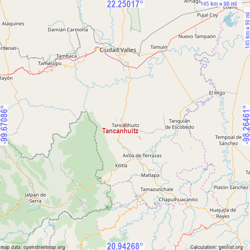
Tancanhuitz GPS coordinates[2]
21° 35' 52.44" North, 98° 58' 3.828" West
| Map corner | latitude | longitude |
|---|---|---|
| Upper-left | 22.25017°, | -99.67086° |
| Center: | 21.5979°, | -98.96773° |
| Lower-right: | 20.94268°, | -98.26461° |
| Map W x H: | 145.4×145.4 km | = 90.3×90.3mi |
| max Lat: | 32.7° ⇑18.1% North |
| Tancanhuitz: | 21.5979° |
| min Lat: | ⇓81.9% South 14.53588° |
| min Long | Tancanhuitz | max Long |
| -117.105° | -98.96773° | -86.73105° |
| W 50.7%⇐ | ⇒49.3% E |
Elevation
Elevation of Tancanhuitz is 216 m = 709 ft, and this is 1037.7 m = 3405 ft below average elevation for this country.
| Max E: |
3497 m = 11473 ft | 75.2% |
| Avg. | 1253.7 m = 4113 ft | |
| Tancanhuitz | 216 m = 709 ft | |
Min E: |
-1 m = -3 ft | 24.8% |
See also: Mexico elevation on elevation.city.
Geographical zone
Tancanhuitz is located in North Torrid zone (between Equator and Tropic of Cancer). Distance of this Northern Tropic circle is 204.5 km =127.1 mi to North.| Distance of | km | miles | from Tancanhuitz |
|---|---|---|---|
| North Pole | 7605.6 | 4725.9 | to North |
| Arctic Circle | 4999.7 | 3106.7 | to North |
| Tropic Cancer | 204.5 | 127.1 | to North |
| Equator | 2401.5 | 1492.2 | to South |


Nearby cities:
15 places around Tancanhuitz: (largest is in red/bold)
• Aquismón
6 km =3.7 mi,  296°
296°
• Cruz Blanca
7.3 km =4.5 mi,  209°
209°
• Huehuetlán
5.7 km =3.5 mi,  179°
179°
• La Pimienta
8.8 km =5.5 mi, 207°
• Lanim
4.1 km =2.5 mi,  289°
289°
• San Antonio
7.1 km =4.4 mi,  69°
69°
• San José Pequetzén
3.6 km =2.2 mi,  13°
13°
• Santa Bárbara
5.3 km =3.3 mi,  232°
232°
• Tamcuime
4.5 km =2.8 mi,  274°
274°
• Tampate
7.3 km =4.5 mi,  305°
305°
• Tan Jajnec
8.6 km =5.3 mi,  61°
61°
• Tandzumadz
3.9 km =2.4 mi,  199°
199°
• Tanleab Uno
6.2 km =3.9 mi,  169°
169°
• Tantocoy Uno
7.8 km =4.8 mi, 198°
• Tzinejá Uno
3.5 km =2.2 mi, 178°
Sources, notices
• [Note1] Compared only with cities in Mexico existing in our database
• [Src1] Map data: © OpenStreetMap contributors (CC-BY-SA)
• [Src2] Other city data from geonames.org with taken over terms of usage.
• [Src3] Geographical zone / Annual Mean Temperature by Robert A. Rohde @ Wikipedia
