Naupan geodata
Naupan (Puebla) is a seat of a second-order administrative division; located in Mexico in America/Mexico_City (GMT-6) time zone. With population of 1,691 people, there are 5135 cities with bigger population in this country. Compared to other cities in Mexico, 62.1% of cities are located further ↓South; 62.4% of cities are located further ←West and 54.2% of cities have lower elevation than Naupan. Note1


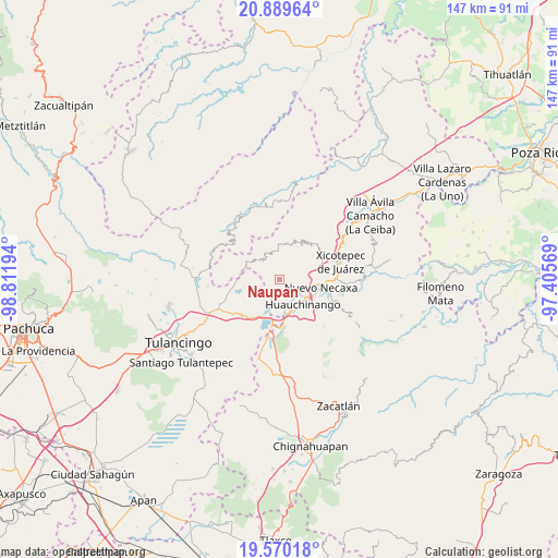
Naupan GPS coordinates[2]
20° 13' 52.716" North, 98° 6' 31.716" West
| Map corner | latitude | longitude |
|---|---|---|
| Upper-left | 20.88964°, | -98.81194° |
| Center: | 20.23131°, | -98.10881° |
| Lower-right: | 19.57018°, | -97.40569° |
| Map W x H: | 146.7×146.7 km | = 91.2×91.2mi |
| max Lat: | 32.7° ⇑37.9% North |
| Naupan: | 20.23131° |
| min Lat: | ⇓62.1% South 14.53588° |
| min Long | Naupan | max Long |
| -117.105° | -98.10881° | -86.73105° |
| W 62.4%⇐ | ⇒37.6% E |
Elevation
Elevation of Naupan is 1566 m = 5138 ft, and this is 312.3 m = 1025 ft above average elevation for this country.
| Max E: |
3497 m = 11473 ft | 45.8% |
| Naupan | 1566 m 5138 ft | |
| Avg. | 1253.7 m = 4113 ft | |
Min E: |
-1 m = -3 ft | 54.2% |
See also: Mexico elevation on elevation.city.
Geographical zone
Naupan is located in North Torrid zone (between Equator and Tropic of Cancer). Distance of this Northern Tropic circle is 356.4 km =221.5 mi to North.| Distance of | km | miles | from Naupan |
|---|---|---|---|
| North Pole | 7757.6 | 4820.3 | to North |
| Arctic Circle | 5151.7 | 3201.1 | to North |
| Tropic Cancer | 356.4 | 221.5 | to North |
| Equator | 2249.5 | 1397.8 | to South |


Nearby cities:
15 places around Naupan: (largest is in red/bold)
• Atla
5.2 km =3.2 mi,  341°
341°
• Atlantongo
3.9 km =2.4 mi, 344°
• Chachahuantla
4.1 km =2.5 mi,  217°
217°
• Chimalapa
7.2 km =4.5 mi,  228°
228°
• Copila
5.4 km =3.4 mi,  30°
30°
• Cuahuihuitzotitla
3.6 km =2.2 mi,  194°
194°
• Cueyatla
7.2 km =4.5 mi,  21°
21°
• Huilacapixtla
3.5 km =2.2 mi,  126°
126°
• Icxotitla
1.5 km =0.9 mi, 34°
• Paciotla
8 km =5 mi,  334°
334°
• Pahuatlán de Valle
6.7 km =4.2 mi,  320°
320°
• San Francisco Atotonilco
6 km =3.7 mi, 227°
• San Miguel del Resgate
7 km =4.3 mi,  267°
267°
• Tlaxpanaloya
1.3 km =0.8 mi,  243°
243°
• Xolotla
3.9 km =2.4 mi, 319°
Sources, notices
• [Note1] Compared only with cities in Mexico existing in our database
• [Src1] Map data: © OpenStreetMap contributors (CC-BY-SA)
• [Src2] Other city data from geonames.org with taken over terms of usage.
• [Src3] Geographical zone / Annual Mean Temperature by Robert A. Rohde @ Wikipedia
