Pacho Viejo geodata
Pacho Viejo (Veracruz) is a populated place; located in Mexico in America/Mexico_City (GMT-6) time zone. With population of 4,965 people, there are 1861 cities with bigger population in this country. Compared to other cities in Mexico, 54.4% of cities are located further ↑North; 75.9% of cities are located further ←West and 54.8% of cities have higher elevation than Pacho Viejo. Note1


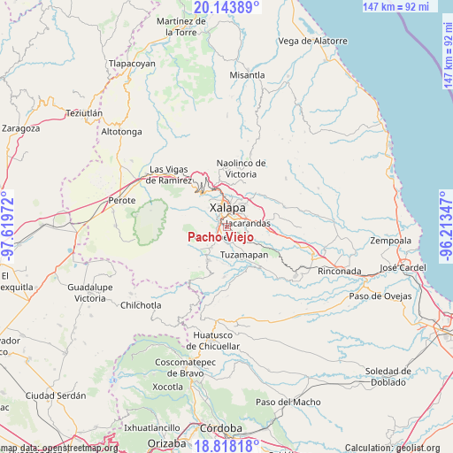
Pacho Viejo GPS coordinates[2]
19° 28' 56.604" North, 96° 54' 59.724" West
| Map corner | latitude | longitude |
|---|---|---|
| Upper-left | 20.14389°, | -97.61972° |
| Center: | 19.48239°, | -96.91659° |
| Lower-right: | 18.81818°, | -96.21347° |
| Map W x H: | 147.4×147.4 km | = 91.6×91.6mi |
| max Lat: | 32.7° ⇑54.4% North |
| Pacho Viejo: | 19.48239° |
| min Lat: | ⇓45.6% South 14.53588° |
| min Long | Pacho Viejo | max Long |
| -117.105° | -96.91659° | -86.73105° |
| W 75.9%⇐ | ⇒24.1% E |
Elevation
Elevation of Pacho Viejo is 1204 m = 3950 ft, and this is 49.7 m = 163 ft below average elevation for this country.
| Max E: |
3497 m = 11473 ft | 54.8% |
| Avg. | 1253.7 m = 4113 ft | |
| Pacho Viejo | 1204 m = 3950 ft | |
Min E: |
-1 m = -3 ft | 45.2% |
See also: Mexico elevation on elevation.city.
Geographical zone
Pacho Viejo is located in North Torrid zone (between Equator and Tropic of Cancer). Distance of this Northern Tropic circle is 439.7 km =273.2 mi to North.| Distance of | km | miles | from Pacho Viejo |
|---|---|---|---|
| North Pole | 7840.8 | 4872 | to North |
| Arctic Circle | 5234.9 | 3252.8 | to North |
| Tropic Cancer | 439.7 | 273.2 | to North |
| Equator | 2166.2 | 1346 | to South |


Nearby cities:
15 places around Pacho Viejo: (largest is in red/bold)
• Alborada
6.1 km =3.8 mi,  128°
128°
• Coatepec
5.8 km =3.6 mi,  234°
234°
• Colonia Santa Bárbara
4.6 km =2.9 mi,  61°
61°
• Colonia la Perseverancia
5.2 km =3.2 mi,  74°
74°
• El Grande
5.4 km =3.4 mi,  179°
179°
• Fraccionamiento las Fuentes
3.5 km =2.2 mi, 64°
• La Laguna
1.8 km =1.1 mi,  269°
269°
• La Orduña
4 km =2.5 mi,  210°
210°
• Las Lomas
4 km =2.5 mi,  164°
164°
• Las Trancas
6 km =3.7 mi, 65°
• Lomas Verdes
3.8 km =2.4 mi,  49°
49°
• Mariano Escobedo
3.4 km =2.1 mi,  299°
299°
• Pacho Nuevo
4 km =2.5 mi,  98°
98°
• Xalapa de Enríquez
5.4 km =3.4 mi,  0°
0°
• Zimpizahua
6.3 km =3.9 mi, 211°
Sources, notices
• [Note1] Compared only with cities in Mexico existing in our database
• [Src1] Map data: © OpenStreetMap contributors (CC-BY-SA)
• [Src2] Other city data from geonames.org with taken over terms of usage.
• [Src3] Geographical zone / Annual Mean Temperature by Robert A. Rohde @ Wikipedia
