Nanayatla geodata
Nanayatla (Hidalgo) is a populated place; located in Mexico in America/Mexico_City (GMT-6) time zone. With population of 544 people, there are 15626 cities with bigger population in this country. Compared to other cities in Mexico, 73.7% of cities are located further ↓South; 60.4% of cities are located further ←West and 69.6% of cities have higher elevation than Nanayatla. Note1


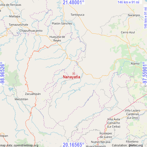
Nanayatla GPS coordinates[2]
20° 49' 27.336" North, 98° 15' 43.668" West
| Map corner | latitude | longitude |
|---|---|---|
| Upper-left | 21.48001°, | -98.96526° |
| Center: | 20.82426°, | -98.26213° |
| Lower-right: | 20.16565°, | -97.55901° |
| Map W x H: | 146.1×146.1 km | = 90.8×90.8mi |
| max Lat: | 32.7° ⇑26.3% North |
| Nanayatla: | 20.82426° |
| min Lat: | ⇓73.7% South 14.53588° |
| min Long | Nanayatla | max Long |
| -117.105° | -98.26213° | -86.73105° |
| W 60.4%⇐ | ⇒39.6% E |
Elevation
Elevation of Nanayatla is 436 m = 1430 ft, and this is 817.7 m = 2683 ft below average elevation for this country.
| Max E: |
3497 m = 11473 ft | 69.6% |
| Avg. | 1253.7 m = 4113 ft | |
| Nanayatla | 436 m = 1430 ft | |
Min E: |
-1 m = -3 ft | 30.4% |
See also: Mexico elevation on elevation.city.
Geographical zone
Nanayatla is located in North Torrid zone (between Equator and Tropic of Cancer). Distance of this Northern Tropic circle is 290.5 km =180.5 mi to North.| Distance of | km | miles | from Nanayatla |
|---|---|---|---|
| North Pole | 7691.6 | 4779.3 | to North |
| Arctic Circle | 5085.7 | 3160.1 | to North |
| Tropic Cancer | 290.5 | 180.5 | to North |
| Equator | 2315.4 | 1438.7 | to South |


Nearby cities:
15 places around Nanayatla: (largest is in red/bold)
• Acanoa
3 km =1.9 mi,  194°
194°
• Atlalco
2.5 km =1.6 mi,  255°
255°
• Chiapa
8 km =5 mi,  323°
323°
• El Mamey
7.2 km =4.5 mi,  212°
212°
• Ohuatipa
7.7 km =4.8 mi,  0°
0°
• Otlamalacatl
4.1 km =2.5 mi,  75°
75°
• Otlatzintla
5.2 km =3.2 mi,  164°
164°
• Pachiquita
7.9 km =4.9 mi,  287°
287°
• Pocantla
5.7 km =3.5 mi, 292°
• Pohuantitla
7.1 km =4.4 mi,  313°
313°
• Primo Verdad
4.9 km =3 mi,  93°
93°
• Tetzacual
5.7 km =3.5 mi, 186°
• Tlaltecatla
5.1 km =3.2 mi,  332°
332°
• Xochiatipan de Castillo
2.7 km =1.7 mi,  296°
296°
• Xocotitla
3.8 km =2.4 mi,  250°
250°
Sources, notices
• [Note1] Compared only with cities in Mexico existing in our database
• [Src1] Map data: © OpenStreetMap contributors (CC-BY-SA)
• [Src2] Other city data from geonames.org with taken over terms of usage.
• [Src3] Geographical zone / Annual Mean Temperature by Robert A. Rohde @ Wikipedia
