Otlamalacatl geodata
Otlamalacatl (Hidalgo) is a populated place; located in Mexico in America/Mexico_City (GMT-6) time zone. With population of 769 people, there are 11375 cities with bigger population in this country. Compared to other cities in Mexico, 73.8% of cities are located further ↓South; 60.9% of cities are located further ←West and 70.9% of cities have higher elevation than Otlamalacatl. Note1


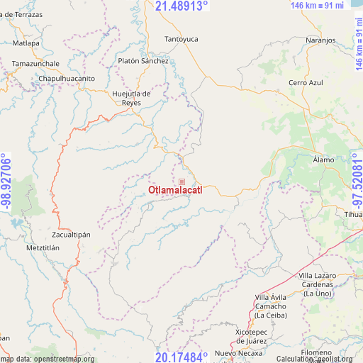
Otlamalacatl GPS coordinates[2]
20° 50' 0.312" North, 98° 13' 26.148" West
| Map corner | latitude | longitude |
|---|---|---|
| Upper-left | 21.48913°, | -98.92706° |
| Center: | 20.83342°, | -98.22393° |
| Lower-right: | 20.17484°, | -97.52081° |
| Map W x H: | 146.1×146.1 km | = 90.8×90.8mi |
| max Lat: | 32.7° ⇑26.2% North |
| Otlamalacatl: | 20.83342° |
| min Lat: | ⇓73.8% South 14.53588° |
| min Long | Otlamalacatl | max Long |
| -117.105° | -98.22393° | -86.73105° |
| W 60.9%⇐ | ⇒39.1% E |
Elevation
Elevation of Otlamalacatl is 374 m = 1227 ft, and this is 879.7 m = 2886 ft below average elevation for this country.
| Max E: |
3497 m = 11473 ft | 70.9% |
| Avg. | 1253.7 m = 4113 ft | |
| Otlamalacatl | 374 m = 1227 ft | |
Min E: |
-1 m = -3 ft | 29.1% |
See also: Mexico elevation on elevation.city.
Geographical zone
Otlamalacatl is located in North Torrid zone (between Equator and Tropic of Cancer). Distance of this Northern Tropic circle is 289.5 km =179.9 mi to North.| Distance of | km | miles | from Otlamalacatl |
|---|---|---|---|
| North Pole | 7690.6 | 4778.7 | to North |
| Arctic Circle | 5084.7 | 3159.5 | to North |
| Tropic Cancer | 289.5 | 179.9 | to North |
| Equator | 2316.5 | 1439.4 | to South |


Nearby cities:
15 places around Otlamalacatl: (largest is in red/bold)
• Acanoa
6.2 km =3.9 mi,  230°
230°
• Atlalco
6.6 km =4.1 mi,  255°
255°
• Benito Juárez
6.2 km =3.9 mi,  17°
17°
• Calaco
7.1 km =4.4 mi,  33°
33°
• Hueycuatitla
6.3 km =3.9 mi,  52°
52°
• La Reforma
8.3 km =5.2 mi,  103°
103°
• Nanayatla
4.1 km =2.5 mi, 255°
• Ohuatipa
7.7 km =4.8 mi,  329°
329°
• Otlatzintla
6.5 km =4 mi,  202°
202°
• Pocantla
9.3 km =5.8 mi,  276°
276°
• Primo Verdad
1.6 km =1 mi,  145°
145°
• Tetzacual
8.1 km =5 mi,  214°
214°
• Tlaltecatla
7.2 km =4.5 mi,  298°
298°
• Xochiatipan de Castillo
6.4 km =4 mi,  271°
271°
• Xocotitla
7.9 km =4.9 mi,  253°
253°
Sources, notices
• [Note1] Compared only with cities in Mexico existing in our database
• [Src1] Map data: © OpenStreetMap contributors (CC-BY-SA)
• [Src2] Other city data from geonames.org with taken over terms of usage.
• [Src3] Geographical zone / Annual Mean Temperature by Robert A. Rohde @ Wikipedia
