Ohuatipa geodata
Ohuatipa (Hidalgo) is a populated place; located in Mexico in America/Mexico_City (GMT-6) time zone. With population of 2,130 people, there are 4111 cities with bigger population in this country. Compared to other cities in Mexico, 74.7% of cities are located further ↓South; 60.4% of cities are located further ←West and 70.7% of cities have higher elevation than Ohuatipa. Note1


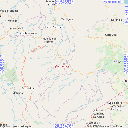
Ohuatipa GPS coordinates[2]
20° 53' 35.088" North, 98° 15' 43.092" West
| Map corner | latitude | longitude |
|---|---|---|
| Upper-left | 21.54852°, | -98.9651° |
| Center: | 20.89308°, | -98.26197° |
| Lower-right: | 20.23476°, | -97.55885° |
| Map W x H: | 146.1×146.1 km | = 90.8×90.8mi |
| max Lat: | 32.7° ⇑25.3% North |
| Ohuatipa: | 20.89308° |
| min Lat: | ⇓74.7% South 14.53588° |
| min Long | Ohuatipa | max Long |
| -117.105° | -98.26197° | -86.73105° |
| W 60.4%⇐ | ⇒39.6% E |
Elevation
Elevation of Ohuatipa is 383 m = 1257 ft, and this is 870.7 m = 2857 ft below average elevation for this country.
| Max E: |
3497 m = 11473 ft | 70.7% |
| Avg. | 1253.7 m = 4113 ft | |
| Ohuatipa | 383 m = 1257 ft | |
Min E: |
-1 m = -3 ft | 29.3% |
See also: Mexico elevation on elevation.city.
Geographical zone
Ohuatipa is located in North Torrid zone (between Equator and Tropic of Cancer). Distance of this Northern Tropic circle is 282.8 km =175.7 mi to North.| Distance of | km | miles | from Ohuatipa |
|---|---|---|---|
| North Pole | 7684 | 4774.6 | to North |
| Arctic Circle | 5078.1 | 3155.4 | to North |
| Tropic Cancer | 282.8 | 175.7 | to North |
| Equator | 2323.1 | 1443.5 | to South |


Nearby cities:
15 places around Ohuatipa: (largest is in red/bold)
• Acatepec
6.8 km =4.2 mi,  349°
349°
• Acatipa
2.7 km =1.7 mi, 354°
• Benito Juárez
5.9 km =3.7 mi,  97°
97°
• Calaco
8 km =5 mi, 95°
• Chiapa
4.9 km =3 mi,  255°
255°
• Chiatitla
7.5 km =4.7 mi,  281°
281°
• Ixtaczoquio
2 km =1.2 mi, 352°
• Nanayatla
7.7 km =4.8 mi,  180°
180°
• Otlamalacatl
7.7 km =4.8 mi,  149°
149°
• Oxeloco
7.2 km =4.5 mi,  293°
293°
• Pocantla
7.6 km =4.7 mi,  223°
223°
• Pohuantitla
5.8 km =3.6 mi,  242°
242°
• Texoloc
2.8 km =1.7 mi,  18°
18°
• Tlaltecatla
3.9 km =2.4 mi, 216°
• Xochiatipan de Castillo
6.9 km =4.3 mi,  200°
200°
Sources, notices
• [Note1] Compared only with cities in Mexico existing in our database
• [Src1] Map data: © OpenStreetMap contributors (CC-BY-SA)
• [Src2] Other city data from geonames.org with taken over terms of usage.
• [Src3] Geographical zone / Annual Mean Temperature by Robert A. Rohde @ Wikipedia
