Mapastepec geodata
Mapastepec (Chiapas) is a populated place; located in Mexico in America/Mexico_City (GMT-6) time zone. With population of 17,931 people, there are 545 cities with bigger population in this country. Compared to other cities in Mexico, 98.7% of cities are located further ↑North; 89.2% of cities are located further ←West and 85% of cities have higher elevation than Mapastepec. Note1


Mapastepec GPS coordinates[2]
15° 26' 0.888" North, 92° 54' 1.404" West
| Map corner | latitude | longitude |
|---|---|---|
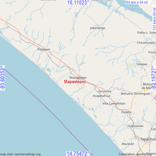
| Upper-left | 16.11023°, | -93.60352° |
| Center: | 15.43358°, | -92.90039° |
| Lower-right: | 14.75472°, | -92.19727° |
| Map W x H: | 150.7×150.7 km | = 93.6×93.6mi |
| max Lat: | 32.7° ⇑98.7% North |
| Mapastepec: | 15.43358° |
| min Lat: | ⇓1.3% South 14.53588° |
| min Long | Mapastepec | max Long |
| -117.105° | -92.90039° | -86.73105° |
| W 89.2%⇐ | ⇒10.8% E |
Elevation
Elevation of Mapastepec is 44 m = 144 ft, and this is 1209.7 m = 3969 ft below average elevation for this country.
| Max E: |
3497 m = 11473 ft | 85% |
| Avg. | 1253.7 m = 4113 ft | |
| Mapastepec | 44 m = 144 ft | |
Min E: |
-1 m = -3 ft | 15% |
See also: Mexico elevation on elevation.city.
Geographical zone
Mapastepec is located in North Torrid zone (between Equator and Tropic of Cancer). Distance of this Northern Tropic circle is 889.9 km =553 mi to North.| Distance of | km | miles | from Mapastepec |
|---|---|---|---|
| North Pole | 8291 | 5151.8 | to North |
| Arctic Circle | 5685.1 | 3532.6 | to North |
| Tropic Cancer | 889.9 | 553 | to North |
| Equator | 1716.1 | 1066.3 | to South |


Nearby cities:
15 places around Mapastepec: (largest is in red/bold)
• Abraham González
7.5 km =4.7 mi,  179°
179°
• Adolfo López Mateos
12.2 km =7.6 mi,  286°
286°
• Doctor Samuel León Brindis
11.1 km =6.9 mi,  316°
316°
• El Consuelo Ulapa
12.7 km =7.9 mi,  114°
114°
• Flores Magón
7.4 km =4.6 mi, 111°
• Generación 2000 Nuevo Milenio
3.8 km =2.4 mi,  11°
11°
• Guadalupe Victoria
8.3 km =5.2 mi,  15°
15°
• Hermenegildo Galeana
17.5 km =10.9 mi, 318°
• Jiquilpan
15.9 km =9.9 mi,  140°
140°
• La Alianza
7.5 km =4.7 mi,  155°
155°
• Miguel Alemán Valdez (Jericó)
17.4 km =10.8 mi,  313°
313°
• Nicolás Bravo Dos Anexo Emiliano Zapata
12.4 km =7.7 mi,  152°
152°
• Nueva Costa Rica
10.1 km =6.3 mi,  67°
67°
• Nueva Sesecapa
9.1 km =5.7 mi, 112°
• Nuevo Milenio Valdivia
9.3 km =5.8 mi,  326°
326°
Sources, notices
• [Note1] Compared only with cities in Mexico existing in our database
• [Src1] Map data: © OpenStreetMap contributors (CC-BY-SA)
• [Src2] Other city data from geonames.org with taken over terms of usage.
• [Src3] Geographical zone / Annual Mean Temperature by Robert A. Rohde @ Wikipedia
