Maconí geodata
Maconí (Querétaro) is a populated place; located in Mexico in America/Mexico_City (GMT-6) time zone. With population of 756 people, there are 11581 cities with bigger population in this country. Compared to other cities in Mexico, 73.8% of cities are located further ↓South; 57.4% of cities are located further →East and 59.4% of cities have lower elevation than Maconí. Note1


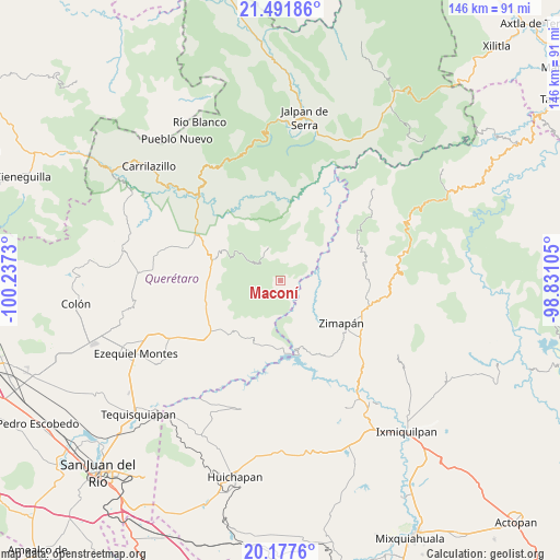
Maconí GPS coordinates[2]
20° 50' 10.176" North, 99° 32' 3.012" West
| Map corner | latitude | longitude |
|---|---|---|
| Upper-left | 21.49186°, | -100.2373° |
| Center: | 20.83616°, | -99.53417° |
| Lower-right: | 20.1776°, | -98.83105° |
| Map W x H: | 146.1×146.1 km | = 90.8×90.8mi |
| max Lat: | 32.7° ⇑26.2% North |
| Maconí: | 20.83616° |
| min Lat: | ⇓73.8% South 14.53588° |
| min Long | Maconí | max Long |
| -117.105° | -99.53417° | -86.73105° |
| W 42.6%⇐ | ⇒57.4% E |
Elevation
Elevation of Maconí is 1716 m = 5630 ft, and this is 462.3 m = 1517 ft above average elevation for this country.
| Max E: |
3497 m = 11473 ft | 40.6% |
| Maconí | 1716 m 5630 ft | |
| Avg. | 1253.7 m = 4113 ft | |
Min E: |
-1 m = -3 ft | 59.4% |
See also: Mexico elevation on elevation.city.
Geographical zone
Maconí is located in North Torrid zone (between Equator and Tropic of Cancer). Distance of this Northern Tropic circle is 289.2 km =179.7 mi to North.| Distance of | km | miles | from Maconí |
|---|---|---|---|
| North Pole | 7690.3 | 4778.5 | to North |
| Arctic Circle | 5084.4 | 3159.3 | to North |
| Tropic Cancer | 289.2 | 179.7 | to North |
| Equator | 2316.8 | 1439.6 | to South |


Nearby cities:
15 places around Maconí: (largest is in red/bold)
• Bella Vista del Río
16.7 km =10.4 mi,  193°
193°
• Benito Juárez
17 km =10.6 mi,  122°
122°
• Cerro Prieto
18.6 km =11.6 mi,  218°
218°
• El Palmar
23.9 km =14.9 mi,  228°
228°
• El Tule
21.4 km =13.3 mi, 121°
• Llano Blanco
23.2 km =14.4 mi,  125°
125°
• Los Juárez
12.6 km =7.8 mi,  286°
286°
• Puerto del Salitre
20.5 km =12.7 mi, 232°
• San Javier
21.1 km =13.1 mi,  243°
243°
• San Joaquín
9.4 km =5.8 mi,  339°
339°
• Sombrerete
14.8 km =9.2 mi,  249°
249°
• Tlalpan
22.3 km =13.9 mi, 126°
• Vizarrón
19.3 km =12 mi,  268°
268°
• Zimapan
19.2 km =11.9 mi, 124°
• Álvaro Obregón
22.1 km =13.7 mi, 130°
Sources, notices
• [Note1] Compared only with cities in Mexico existing in our database
• [Src1] Map data: © OpenStreetMap contributors (CC-BY-SA)
• [Src2] Other city data from geonames.org with taken over terms of usage.
• [Src3] Geographical zone / Annual Mean Temperature by Robert A. Rohde @ Wikipedia
