Bella Vista del Río geodata
Bella Vista del Río (Querétaro) is a populated place; located in Mexico in America/Mexico_City (GMT-6) time zone. With population of 1,955 people, there are 4454 cities with bigger population in this country. Compared to other cities in Mexico, 71.5% of cities are located further ↓South; 58% of cities are located further →East and 67.3% of cities have lower elevation than Bella Vista del Río. Note1


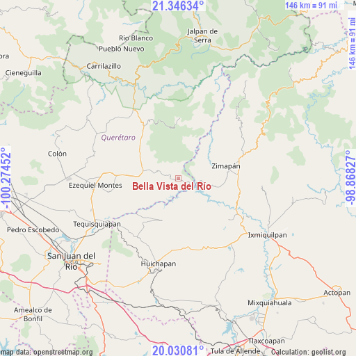
Bella Vista del Río GPS coordinates[2]
20° 41' 24" North, 99° 34' 17.004" West
| Map corner | latitude | longitude |
|---|---|---|
| Upper-left | 21.34634°, | -100.27452° |
| Center: | 20.69°, | -99.57139° |
| Lower-right: | 20.03081°, | -98.86827° |
| Map W x H: | 146.3×146.3 km | = 90.9×90.9mi |
| max Lat: | 32.7° ⇑28.5% North |
| Bella Vista del Río: | 20.69° |
| min Lat: | ⇓71.5% South 14.53588° |
| min Long | Bella Vista del | max Long |
| -117.105° | -99.57139° | -86.73105° |
| W 42%⇐ | ⇒58% E |
Elevation
Elevation of Bella Vista del Río is 1875 m = 6152 ft, and this is 621.3 m = 2038 ft above average elevation for this country.
| Max E: |
3497 m = 11473 ft | 32.7% |
| Bella Vista del Río | 1875 m 6152 ft | |
| Avg. | 1253.7 m = 4113 ft | |
Min E: |
-1 m = -3 ft | 67.3% |
See also: Mexico elevation on elevation.city.
Geographical zone
Bella Vista del Río is located in North Torrid zone (between Equator and Tropic of Cancer). Distance of this Northern Tropic circle is 305.4 km =189.8 mi to North.| Distance of | km | miles | from Bella Vista del Río |
|---|---|---|---|
| North Pole | 7706.5 | 4788.6 | to North |
| Arctic Circle | 5100.7 | 3169.4 | to North |
| Tropic Cancer | 305.4 | 189.8 | to North |
| Equator | 2300.5 | 1429.5 | to South |


Nearby cities:
15 places around Bella Vista del Río: (largest is in red/bold)
• Banzha
11.4 km =7.1 mi,  188°
188°
• Benito Juárez
19.5 km =12.1 mi,  68°
68°
• Boyecito
16.3 km =10.1 mi,  225°
225°
• Boyé
17.5 km =10.9 mi,  266°
266°
• Cerro Prieto
7.8 km =4.8 mi,  282°
282°
• El Palmar
14.1 km =8.8 mi, 271°
• El Riíto
14 km =8.7 mi,  205°
205°
• Maconí
16.7 km =10.4 mi,  13°
13°
• Pathé
16.8 km =10.4 mi, 233°
• Puerto del Salitre
12.9 km =8 mi,  286°
286°
• San Javier
16.7 km =10.4 mi, 294°
• San Pedro
10.6 km =6.6 mi,  147°
147°
• Sombrerete
15 km =9.3 mi,  318°
318°
• Tecozautla
18.6 km =11.6 mi,  200°
200°
• Uxdejhé
15.7 km =9.8 mi,  219°
219°
Sources, notices
• [Note1] Compared only with cities in Mexico existing in our database
• [Src1] Map data: © OpenStreetMap contributors (CC-BY-SA)
• [Src2] Other city data from geonames.org with taken over terms of usage.
• [Src3] Geographical zone / Annual Mean Temperature by Robert A. Rohde @ Wikipedia
