San Andrés Lovene geodata
San Andrés Lovene (Oaxaca) is a populated place; located in Mexico in America/Mexico_City (GMT-6) time zone. With population of 967 people, there are 9002 cities with bigger population in this country. Compared to other cities in Mexico, 97.1% of cities are located further ↑North; 81.4% of cities are located further ←West and 72% of cities have lower elevation than San Andrés Lovene. Note1


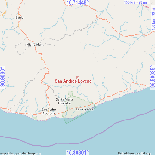
San Andrés Lovene GPS coordinates[2]
16° 2' 23.604" North, 96° 12' 12.492" West
| Map corner | latitude | longitude |
|---|---|---|
| Upper-left | 16.71448°, | -96.9066° |
| Center: | 16.03989°, | -96.20347° |
| Lower-right: | 15.36301°, | -95.50035° |
| Map W x H: | 150.3×150.3 km | = 93.4×93.4mi |
| max Lat: | 32.7° ⇑97.1% North |
| San Andrés Lovene: | 16.03989° |
| min Lat: | ⇓2.9% South 14.53588° |
| min Long | San Andrés Lov | max Long |
| -117.105° | -96.20347° | -86.73105° |
| W 81.4%⇐ | ⇒18.6% E |
Elevation
Elevation of San Andrés Lovene is 1967 m = 6453 ft, and this is 713.3 m = 2340 ft above average elevation for this country.
| Max E: |
3497 m = 11473 ft | 28% |
| San Andrés Lovene | 1967 m 6453 ft | |
| Avg. | 1253.7 m = 4113 ft | |
Min E: |
-1 m = -3 ft | 72% |
See also: Mexico elevation on elevation.city.
Geographical zone
San Andrés Lovene is located in North Torrid zone (between Equator and Tropic of Cancer). Distance of this Northern Tropic circle is 822.5 km =511.1 mi to North.| Distance of | km | miles | from San Andrés Lovene |
|---|---|---|---|
| North Pole | 8223.6 | 5109.9 | to North |
| Arctic Circle | 5617.7 | 3490.7 | to North |
| Tropic Cancer | 822.5 | 511.1 | to North |
| Equator | 1783.5 | 1108.2 | to South |


Nearby cities:
15 places around San Andrés Lovene: (largest is in red/bold)
• Merced del Potrero
14.2 km =8.8 mi,  86°
86°
• San Felipe Lachilló
6.1 km =3.8 mi,  122°
122°
• San Francisco Ozolotepec
7 km =4.3 mi,  343°
343°
• San Gregorio Ozolotepec
16.9 km =10.5 mi,  307°
307°
• San Juan Guivini
6.7 km =4.2 mi,  8°
8°
• San Juan Ozolotepec
12 km =7.5 mi,  330°
330°
• San Mateo Piñas
14.7 km =9.1 mi,  252°
252°
• San Miguel del Puerto
13.5 km =8.4 mi,  166°
166°
• Santa Cruz Ozolotepec
11.1 km =6.9 mi,  287°
287°
• Santa María Ozolotepec
20.7 km =12.9 mi,  300°
300°
• Santa María Petatengo
21.1 km =13.1 mi,  112°
112°
• Santa María Xadani
17.2 km =10.7 mi,  126°
126°
• Santiago Lapaguía
10.7 km =6.6 mi, 6°
• Santiago Xanica
4 km =2.5 mi,  214°
214°
• Santo Domingo Ozolotepec
16.8 km =10.4 mi,  317°
317°
Sources, notices
• [Note1] Compared only with cities in Mexico existing in our database
• [Src1] Map data: © OpenStreetMap contributors (CC-BY-SA)
• [Src2] Other city data from geonames.org with taken over terms of usage.
• [Src3] Geographical zone / Annual Mean Temperature by Robert A. Rohde @ Wikipedia
